|
search place name
|
||
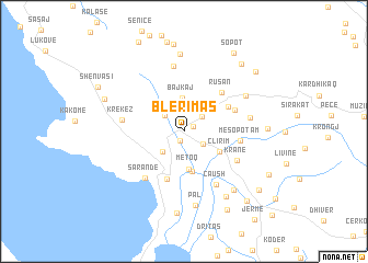
Blerimas (Vlorë, Albania)Blerimas is a town in the Vlorë region of Albania. An overview map of the region around Blerimas is displayed below.
regional and 3d topo map of Blerimas, Albania ::
Blerimas airports ::
The nearest airport is CFU - Kerkyra/corfu Ioannis Kapodistrias Intl, located 36.8 km south of Blerimas.
Other airports nearby include IOA - Ioannina (71.3 km east), KSO - Kastoria Aristotelis (120.9 km north east), PVK - Preveza Aktio (126.7 km south east), OHD - Ohrid (152.2 km north east), Nearby towns ::
Karahaxh (1.0km south) //
Buronjë (0.9km north east) //
Finiq (2.0km south east) //
Stjar (2.1km north east) //
Vanë (2.2km north west) //
Bregas (2.7km south west) //
Bajkaj (3.4km north) //
Bamatat (3.1km north east) //
(( Metoq )) (3.9km south) //
Çlirim (3.4km south east) //
Vrion (4.2km south) //
Gjashtë (5.0km south) //
Vllahat (4.3km north east) //
Rusan (4.9km north east) //
Piadhage (4.5km north east) //
Mesopotam (4.5km east) //
Sarandë (5.6km south west) //
Krane (5.1km south east) //
Çaush (6.0km south east) //
Krekëz (4.9km west) //
Palavli (6.7km north) //
Kostar (5.3km east) //
Delvinë (6.1km north east) //
(( Pal )) (7.6km south) //
Kopaçez (7.9km north) //
Tremul (7.2km south east) //
Aliko (7.4km south east) //
Çukë (8.4km south) //
Brailat (6.6km east) //
[all distances 'as the bird flies' and approximate]  Places with similar names to Blerimas, Albania ::
// Bīl Rāmsa (BD)
Disclaimer :: Information on this page comes without warranty of any kind |
||
|
Where is Blerimas? Elevation and coordinates ::
Latitude (lat): 39°55'6"N Longitude (lon): 20°2'27"E
Elevation (approx.): 49m (map arrows pan, magnifying glasses zoom) |
||
|
Visiting Blerimas? Hotel/Accommodation ::
Book a hotel in Blerimas Travel Guide ::
Buy a travel guide for Albania rental cars ::
car rental offers GPS waypoint ::
download a GPX waypoint (PoI) of Blerimas for your GPS receiver
|
||