|
search place name
|
||
Bubës (Gjirokastër, Albania)Bubës is a town in the Gjirokastër region of Albania. An overview map of the region around Bubës is displayed below.
regional and 3d topo map of Bubës, Albania ::

Bubës airports ::
The nearest airport is CFU - Kerkyra/corfu Ioannis Kapodistrias Intl, located 95.8 km south of Bubës.
Other airports nearby include OHD - Ohrid (97.4 km north east), KSO - Kastoria Aristotelis (100.5 km east), IOA - Ioannina (104.3 km south east), TIA - Tirana Rinas (111.4 km north), Nearby towns ::
Duraj (1.1km north) //
Berzanaj (1.8km north) //
Korat (1.8km south east) //
Kenaj (1.8km east) //
Komarak (2.7km south) //
Shalës (2.4km north west) //
Beqaraj (2.6km north east) //
Kreshovë (3.3km south) //
Kondas (3.1km south west) //
Shanaj (2.8km west) //
Murisht (3.0km east) //
Malas (4.1km north) //
Veleshnjaret (3.5km south east) //
Mazhan (4.6km south) //
Liqeth (4.2km north west) //
Lavdar (4.7km north) //
Vinokash (4.1km south east) //
Shkëmb (5.0km north) //
Dodovec (4.8km north west) //
Goran (5.3km north) //
Golemaj (4.3km west) //
Vendreshë e Malit (4.6km north east) //
Ballaban (5.1km south east) //
Dushallar (5.1km north east) //
Psar (6.0km south) //
Arrëza e Vogël (5.2km south west) //
Saliaj (5.8km south) //
Hambar (4.6km west) //
Selcka e Vogël (5.3km north west) //
[all distances 'as the bird flies' and approximate] 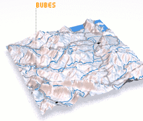 Places with similar names to Bubës, Albania ::
Disclaimer :: Information on this page comes without warranty of any kind |
||
|
Where is Bubës? Elevation and coordinates ::
Latitude (lat): 40°27'10"N Longitude (lon): 20°5'51"E
Elevation (approx.): 678m (map arrows pan, magnifying glasses zoom) |
||
|
Visiting Bubës? Hotel/Accommodation ::
Book a hotel in Bubës Travel Guide ::
Buy a travel guide for Albania rental cars ::
car rental offers GPS waypoint ::
download a GPX waypoint (PoI) of Bubës for your GPS receiver
|
||