|
search place name
|
||
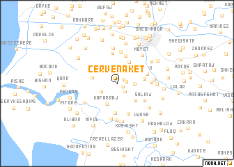
Çervenakët (Fier, Albania)Çervenakët is a town in the Fier region of Albania. An overview map of the region around Çervenakët is displayed below.
regional and 3d topo map of Çervenakët, Albania ::
Çervenakët airports ::
The nearest airport is TIA - Tirana Rinas, located 84.7 km north of Çervenakët.
Other airports nearby include OHD - Ohrid (117.3 km north east), CFU - Kerkyra/corfu Ioannis Kapodistrias Intl (122.8 km south), LCC - Lecce (127.3 km west), BDS - Brindisi Casale (133.5 km west), Nearby towns ::
Metaj (0.8km south east) //
Peshtani i Madh (1.1km north east) //
Shtanas (1.2km east) //
Peshtan-Bregas (1.5km south east) //
Peshtani i Vogël (1.7km north) //
(( Nikas )) (2.1km east) //
Frakulla e Madhe (2.3km south west) //
Kafarraj (3.5km south) //
Muçaj (3.4km south east) //
Drizë (3.8km north) //
Levan (3.2km west) //
Majalli (3.4km east) //
Zhupan (4.6km north) //
Murtez (4.7km south) //
Llapaticë (4.9km north) //
Plyk (3.9km north east) //
Frakulla e Vogël (5.0km south) //
Saliaj (4.3km south east) //
Radostimë (5.1km north) //
Beharaj (4.1km east) //
(( Trocaj )) (5.6km south) //
Vadhizë (5.7km north) //
Adë (5.8km south) //
Stanë (4.5km east) //
Sheq (6.0km south) //
Çerven (5.0km south west) //
Mbyet (5.5km north east) //
Lagjja e Re (4.8km east) //
Hoxhaj (5.4km south east) //
[all distances 'as the bird flies' and approximate] 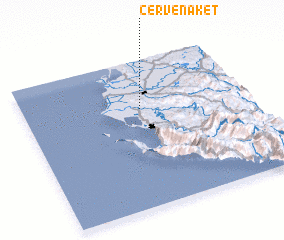 Places with similar names to Çervenakët, Albania ::
// Sarafangady (MG)
Disclaimer :: Information on this page comes without warranty of any kind |
||
|
Where is Çervenakët? Elevation and coordinates ::
Latitude (lat): 40°40'1"N Longitude (lon): 19°31'31"E
Elevation (approx.): 218m (map arrows pan, magnifying glasses zoom) |
||
|
Visiting Çervenakët? Hotel/Accommodation ::
Book a hotel in Çervenakët Travel Guide ::
Buy a travel guide for Albania rental cars ::
car rental offers GPS waypoint ::
download a GPX waypoint (PoI) of Çervenakët for your GPS receiver
|
||