|
search place name
|
||
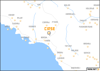
Çirsë (Vlorë, Albania)Çirsë is a town in the Vlorë region of Albania. An overview map of the region around Çirsë is displayed below.
regional and 3d topo map of Çirsë, Albania ::
Çirsë airports ::
The nearest airport is CFU - Kerkyra/corfu Ioannis Kapodistrias Intl, located 53.1 km south of Çirsë.
Other airports nearby include IOA - Ioannina (91.5 km south east), KSO - Kastoria Aristotelis (126.5 km east), OHD - Ohrid (142.6 km north east), TIA - Tirana Rinas (148.9 km north), Nearby towns ::
Borsh (2.4km south west) //
Vane (3.1km south) //
Çorraj (3.9km north) //
Fterë (4.2km north) //
Qazim Pali (4.8km south) //
Qeparoi i Sipërm (4.3km west) //
Qeparo (5.1km south west) //
Kudhës (5.4km north west) //
Piqeras (7.3km south) //
Sasaj (8.1km south) //
Tatzat (7.5km south east) //
Kaparjel (9.2km north east) //
Lagjja e Re (10.3km south east) //
[all distances 'as the bird flies' and approximate]  Places with similar names to Çirsë, Albania ::
Disclaimer :: Information on this page comes without warranty of any kind |
||
|
Where is Çirsë? Elevation and coordinates ::
Latitude (lat): 40°4'45"N Longitude (lon): 19°52'30"E
Elevation (approx.): 293m (map arrows pan, magnifying glasses zoom) |
||
|
Visiting Çirsë? Hotel/Accommodation ::
Book a hotel in Çirsë Travel Guide ::
Buy a travel guide for Albania rental cars ::
car rental offers GPS waypoint ::
download a GPX waypoint (PoI) of Çirsë for your GPS receiver
|
||