|
search place name
|
||
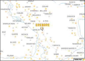
Erebarë (Dibër, Albania)Erebarë is a town in the Dibër region of Albania. An overview map of the region around Erebarë is displayed below.
regional and 3d topo map of Erebarë, Albania ::
Erebarë airports ::
The nearest airport is OHD - Ohrid, located 54.6 km south east of Erebarë.
Other airports nearby include TIA - Tirana Rinas (67.0 km west), SKP - Skopje (102.6 km east), PRN - Pristina (114.9 km north east), TGD - Podgorica (129.7 km north west), Nearby towns ::
Herebel (0.9km south) //
Trepçë (1.5km north) //
Grazhdan (1.8km south) //
Popinarë (1.9km south east) //
Dovolan (2.0km west) //
Melan (3.0km north) //
Ilnicë (3.4km north) //
Pjeçë (3.0km north west) //
Gradec (3.0km south west) //
Pesjakë (3.8km south) //
Fusha e Vogël (3.8km south) //
Kovashicë (3.8km south west) //
Pejkë (3.3km west) //
Grevë (4.3km north) //
Maqellarë (4.4km south) //
Katundi i Vogël (4.0km south east) //
Çernenë (4.7km south) //
Trenë (4.3km north west) //
Pocest (4.7km south east) //
Vojnikë (5.4km south) //
Burim (5.5km south) //
Kërçishti i Poshtëm (5.4km south east) //
Begjunec (6.0km north) //
Majtarë (6.7km south) //
Selane (5.2km north west) //
Topojan (5.8km south west) //
Rabdisht (6.6km north) //
Podgorcë (6.9km south) //
Kërçishti i Epërm (6.3km south east) //
[all distances 'as the bird flies' and approximate] 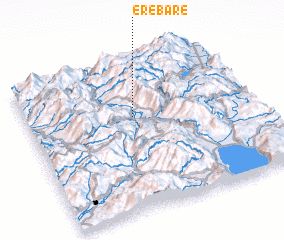
Disclaimer :: Information on this page comes without warranty of any kind |
||
|
Where is Erebarë? Elevation and coordinates ::
Latitude (lat): 41°37'39"N Longitude (lon): 20°28'16"E
Elevation (approx.): 821m (map arrows pan, magnifying glasses zoom) |
||
|
Visiting Erebarë? Hotel/Accommodation ::
Book a hotel in Erebarë Travel Guide ::
Buy a travel guide for Albania rental cars ::
car rental offers GPS waypoint ::
download a GPX waypoint (PoI) of Erebarë for your GPS receiver
|
||