|
search place name
|
||
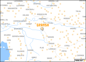
Gramsh (Fier, Albania)Gramsh is a town in the Fier region of Albania. An overview map of the region around Gramsh is displayed below.
regional and 3d topo map of Gramsh, Albania ::
Gramsh airports ::
The nearest airport is TIA - Tirana Rinas, located 43.8 km north of Gramsh.
Other airports nearby include OHD - Ohrid (92.0 km east), KSO - Kastoria Aristotelis (150.6 km south east), BDS - Brindisi Casale (150.7 km west), TGD - Podgorica (152.5 km north), Nearby towns ::
Zhamë (1.8km north) //
Konjat (1.9km south) //
Dushk Peqin (2.5km south east) //
Dushku i Madh (2.9km south) //
(( Sallbegaj )) (2.9km north east) //
Kurtaj (3.0km north east) //
Thanasaj (4.2km north) //
(( Remanaj )) (3.4km east) //
Çerma e Sipërme (4.2km north west) //
Hasmashaj (3.9km east) //
Shegas (4.7km south east) //
Çepkë (5.1km south east) //
Rrogozhinë (6.1km north) //
Gjoçaj (4.7km east) //
Tërbuf (4.9km north west) //
Sinaballaj (5.9km north east) //
Golem (6.2km south) //
Karinë (6.1km north east) //
Çermë-Proshkë (6.0km north west) //
(( Saraç )) (6.5km north east) //
Çelhakaj (5.7km east) //
Virovë (7.2km south east) //
Rosten (7.2km north east) //
Garunjas (6.5km south east) //
(( Golem i Vogël )) (8.1km south) //
(( Allprendaj-Peqin )) (7.4km south east) //
Gosa e Vogël (7.9km north) //
Plug (8.3km south) //
Kodras (8.2km north) //
[all distances 'as the bird flies' and approximate]  Places with similar names to Gramsh, Albania ::
Disclaimer :: Information on this page comes without warranty of any kind |
||
|
Where is Gramsh? Elevation and coordinates ::
Latitude (lat): 41°1'19"N Longitude (lon): 19°40'4"E
Elevation (approx.): 18m (map arrows pan, magnifying glasses zoom) |
||
|
Visiting Gramsh? Hotel/Accommodation ::
Book a hotel in Gramsh Travel Guide ::
Buy a travel guide for Albania rental cars ::
car rental offers GPS waypoint ::
download a GPX waypoint (PoI) of Gramsh for your GPS receiver
|
||