|
search place name
|
||
Halilaj (Fier, Albania)Halilaj is a town in the Fier region of Albania. An overview map of the region around Halilaj is displayed below.
regional and 3d topo map of Halilaj, Albania ::

Halilaj airports ::
The nearest airport is TIA - Tirana Rinas, located 68.4 km north of Halilaj.
Other airports nearby include OHD - Ohrid (102.3 km north east), CFU - Kerkyra/corfu Ioannis Kapodistrias Intl (135.4 km south), LCC - Lecce (141.7 km south west), BDS - Brindisi Casale (143.4 km west), Nearby towns ::
Mertikaj (1.1km north west) //
Kanajak (1.1km south east) //
Bubullimë (1.9km north) //
Vërri (1.8km south west) //
Manaj (2.1km north) //
(( Kolea )) (2.1km north west) //
Gjonas (1.9km east) //
Mullaj (2.2km west) //
Ardenicë (2.7km north west) //
Eskaj (2.9km north east) //
Gopës (3.1km north west) //
Ecër (3.4km south east) //
Kallmi i Vogël (3.8km south) //
Vajkan (3.1km west) //
Kolonjë (3.5km north west) //
(( Kallm Maliqaj )) (4.2km south) //
Pirrë (4.7km north) //
Rrapëz-Fshat (4.9km north) //
Imshtë (3.8km east) //
Lagjja e Re (5.2km south) //
Kamçisht (4.7km north east) //
Drengoj (5.0km north west) //
Gobolesh (5.3km north east) //
Kallmi i Madh (5.7km south) //
(( Kallm-Buxhak )) (6.0km south) //
Mehmet (5.1km south west) //
Jagodinë (5.4km south east) //
Gorre (6.3km north) //
Belinë (6.3km south) //
[all distances 'as the bird flies' and approximate] 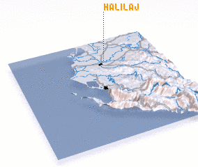
Disclaimer :: Information on this page comes without warranty of any kind |
||
|
Where is Halilaj? Elevation and coordinates ::
Latitude (lat): 40°48'8"N Longitude (lon): 19°38'0"E
Elevation (approx.): 9m (map arrows pan, magnifying glasses zoom) |
||
|
Visiting Halilaj? Hotel/Accommodation ::
Book a hotel in Halilaj Travel Guide ::
Buy a travel guide for Albania rental cars ::
car rental offers GPS waypoint ::
download a GPX waypoint (PoI) of Halilaj for your GPS receiver
|
||