|
search place name
|
||
Koçaj (Fier, Albania)Koçaj is a town in the Fier region of Albania. An overview map of the region around Koçaj is displayed below.
regional and 3d topo map of Koçaj, Albania ::

Koçaj airports ::
The nearest airport is TIA - Tirana Rinas, located 60.5 km north of Koçaj.
Other airports nearby include OHD - Ohrid (87.4 km north east), KSO - Kastoria Aristotelis (135.1 km east), CFU - Kerkyra/corfu Ioannis Kapodistrias Intl (141.5 km south), LCC - Lecce (156.7 km south west), Nearby towns ::
Fier-Shegan (0.6km south) //
Buzaj (1.5km south) //
Krasniq (1.5km south west) //
Çinar (1.5km south east) //
Barbullinjë (1.6km north west) //
Sejmenas (1.7km north east) //
Saliasi (2.3km north) //
Çukasi i Vjetër (2.4km south) //
Çukasi i Ri (2.1km west) //
Ramaj (2.3km south east) //
Piranjak (2.6km south west) //
Ballajt (2.5km north west) //
Kosova e Vogël (3.3km north) //
Biçakaj i Vjetër (2.6km west) //
Delisufaj (3.2km south west) //
Thanë (2.7km east) //
Mingë (3.6km south) //
Daullonjak (3.1km south east) //
Jeta e Re (3.3km north west) //
Allkaj (3.1km south west) //
Kuç (3.8km south) //
Agim (3.8km south east) //
Biçakaj i Ri (3.2km west) //
Toskaj (4.2km south) //
Kosovë (3.9km north east) //
Gajdë (4.0km south east) //
Tahaj (4.6km south) //
Qerreti i Ri (3.8km north west) //
Toshkëz (4.4km south west) //
[all distances 'as the bird flies' and approximate] 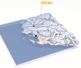 Places with similar names to Koçaj, Albania ::
Disclaimer :: Information on this page comes without warranty of any kind |
||
|
Where is Koçaj? Elevation and coordinates ::
Latitude (lat): 40°52'21"N Longitude (lon): 19°47'10"E
Elevation (approx.): 19m (map arrows pan, magnifying glasses zoom) |
||
|
Visiting Koçaj? Hotel/Accommodation ::
Book a hotel in Koçaj Travel Guide ::
Buy a travel guide for Albania rental cars ::
car rental offers GPS waypoint ::
download a GPX waypoint (PoI) of Koçaj for your GPS receiver
|
||