|
search place name
|
||
Lezollar (Berat, Albania)Lezollar is a town in the Berat region of Albania. An overview map of the region around Lezollar is displayed below.
regional and 3d topo map of Lezollar, Albania ::

Lezollar airports ::
The nearest airport is TIA - Tirana Rinas, located 66.0 km north of Lezollar.
Other airports nearby include OHD - Ohrid (76.5 km north east), KSO - Kastoria Aristotelis (121.4 km east), CFU - Kerkyra/corfu Ioannis Kapodistrias Intl (138.1 km south), IOA - Ioannina (147.8 km south east), Nearby towns ::
Drizë (0.7km south) //
Dugallë (0.8km east) //
Blir (1.4km north west) //
Rrepes (1.7km south) //
Ripëzë (1.5km south east) //
Frashër (2.2km north) //
Gegë (2.0km south west) //
Velagosht (2.0km south east) //
Tabakaj (2.8km south west) //
Kulleni (2.9km north east) //
Zarovë (3.0km north west) //
Broshkollar (3.3km north) //
Goraj (3.7km south) //
Sades (3.6km north east) //
Pashtraj (3.9km south east) //
Novë (3.4km north east) //
Bërzeshtë (3.4km east) //
Dëshiran (4.5km north) //
Elezi (4.0km north west) //
Goriçan (4.3km south east) //
Vlashuk (3.8km west) //
Çelaj (4.3km north east) //
Leshaj (3.9km east) //
Toskollarë (5.0km south) //
Kozarë (4.2km south west) //
Honallinj (5.4km north) //
Dumollë (5.4km south) //
Qosë (5.1km north west) //
Langozaj (4.5km south east) //
[all distances 'as the bird flies' and approximate] 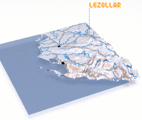 Places with similar names to Lezollar, Albania ::
Disclaimer :: Information on this page comes without warranty of any kind |
||
|
Where is Lezollar? Elevation and coordinates ::
Latitude (lat): 40°50'44"N Longitude (lon): 19°56'48"E
Elevation (approx.): 127m (map arrows pan, magnifying glasses zoom) |
||
|
Visiting Lezollar? Hotel/Accommodation ::
Book a hotel in Lezollar Travel Guide ::
Buy a travel guide for Albania rental cars ::
car rental offers GPS waypoint ::
download a GPX waypoint (PoI) of Lezollar for your GPS receiver
|
||