|
search place name
|
||
Llakatund (Vlorë, Albania)Llakatund is a town in the Vlorë region of Albania. An overview map of the region around Llakatund is displayed below.
regional and 3d topo map of Llakatund, Albania ::

Llakatund airports ::
The nearest airport is TIA - Tirana Rinas, located 99.0 km north of Llakatund.
Other airports nearby include CFU - Kerkyra/corfu Ioannis Kapodistrias Intl (108.8 km south), LCC - Lecce (122.5 km west), OHD - Ohrid (125.3 km north east), BDS - Brindisi Casale (134.1 km west), Nearby towns ::
Drithas (0.8km north) //
Grabian (0.9km south east) //
Bunavi (1.3km south) //
Mekat (1.8km north) //
(( Mëkat i Ri )) (1.8km north east) //
Kërkovë (1.9km west) //
Çeprat (3.0km south) //
Bestrova e Vogël (2.8km south west) //
Beshisht (3.3km north) //
Risili (3.8km south) //
Hoshtimë (3.2km west) //
Babica e Vogël (4.5km south west) //
Bestrovë (3.8km south west) //
Trevëllazër (5.0km north) //
Cerkovinë (4.7km north west) //
Panaja (4.3km west) //
Babica e Madhe (5.7km south) //
Lubonjë (5.2km south east) //
Picar (5.0km east) //
Skrofotinë (5.4km north west) //
(( Goricë )) (5.2km south west) //
(( Kallm Resulaj )) (6.5km north) //
Xhyherinë (6.6km south) //
Kashisht (7.1km north) //
Mesarak (5.9km east) //
Hambar (6.6km north east) //
Veliaj (6.3km east) //
Armen (6.2km east) //
Boriç (6.3km east) //
[all distances 'as the bird flies' and approximate] 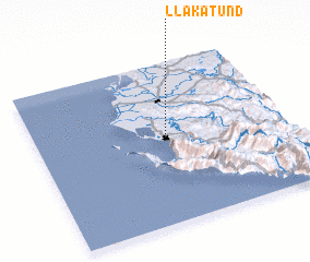 Places with similar names to Llakatund, Albania ::
// Lagoa Danta (BR)
Disclaimer :: Information on this page comes without warranty of any kind |
||
|
Where is Llakatund? Elevation and coordinates ::
Latitude (lat): 40°32'8"N Longitude (lon): 19°31'23"E
Elevation (approx.): 56m (map arrows pan, magnifying glasses zoom) |
||
|
Visiting Llakatund? Hotel/Accommodation ::
Book a hotel in Llakatund Travel Guide ::
Buy a travel guide for Albania rental cars ::
car rental offers GPS waypoint ::
download a GPX waypoint (PoI) of Llakatund for your GPS receiver
|
||