|
search place name
|
||
Lumardhë (Shkodër, Albania)Lumardhë is a town in the Shkodër region of Albania. An overview map of the region around Lumardhë is displayed below.
regional and 3d topo map of Lumardhë, Albania ::

Lumardhë airports ::
The nearest airport is TGD - Podgorica, located 69.4 km north west of Lumardhë.
Other airports nearby include TIA - Tirana Rinas (80.0 km south), PRN - Pristina (99.1 km north east), TIV - Tivat (112.0 km west), OHD - Ohrid (118.7 km south east), Nearby towns ::
Micoj (1.9km south) //
Prrez (2.2km north) //
Orosh (2.6km north east) //
Kryezi (2.8km east) //
Fushë-Arrëz (4.2km south) //
Bicaj (4.6km south west) //
Sapaç (5.6km north) //
Sapaç (5.8km north west) //
Vasiaj (5.3km east) //
Breg (7.0km south) //
Blinisht (5.7km south west) //
Lumëbardhë (6.4km south east) //
Ndërlymnat (7.2km north) //
Mrijaj (5.8km east) //
Rrapë (7.3km south west) //
Qafëmal (6.1km east) //
Palucaj (6.5km south east) //
Lumz (8.8km south) //
Tuç (8.2km south east) //
Prozhm (8.9km south west) //
Buhot (7.9km south west) //
[all distances 'as the bird flies' and approximate] 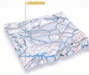 Places with similar names to Lumardhë, Albania ::
// Lambareiði (FO)
Disclaimer :: Information on this page comes without warranty of any kind |
||
|
Where is Lumardhë? Elevation and coordinates ::
Latitude (lat): 42°6'0"N Longitude (lon): 20°1'0"E
Elevation (approx.): 783m (map arrows pan, magnifying glasses zoom) |
||
|
Visiting Lumardhë? Hotel/Accommodation ::
Book a hotel in Lumardhë Travel Guide ::
Buy a travel guide for Albania rental cars ::
car rental offers GPS waypoint ::
download a GPX waypoint (PoI) of Lumardhë for your GPS receiver
|
||