|
search place name
|
||
Myselim (Shkodër, Albania)Myselim is a town in the Shkodër region of Albania. An overview map of the region around Myselim is displayed below.
regional and 3d topo map of Myselim, Albania ::

Myselim airports ::
The nearest airport is TGD - Podgorica, located 38.6 km north west of Myselim.
Other airports nearby include TIV - Tivat (77.2 km north west), TIA - Tirana Rinas (77.2 km south), DBV - Dubrovnik (118.4 km north west), PRN - Pristina (132.2 km north east), Nearby towns ::
Mes (0.8km north east) //
Hot i Ri (1.2km west) //
Bardhaj (1.5km south west) //
Shtoji i Vogël (1.8km south west) //
Dragoç (2.4km north) //
Boks (2.4km north) //
Bleran (2.4km south west) //
Gruda e Re (2.7km north west) //
Maslac (3.2km north east) //
Kullat e Boksit (3.4km north) //
Shtoji i Vjetër (3.1km south west) //
Drisht (3.4km north east) //
Milan (3.8km north east) //
Golem (3.1km west) //
Dobraç (3.4km south west) //
Golemi i Poshtëm (3.4km west) //
Renc (4.6km south) //
Gajtan (4.9km south) //
Rrash i Vorfës (5.1km north) //
Gjoc (4.3km south east) //
Dergjinaj (4.0km west) //
Hysaj (5.5km north) //
Kullaj (5.2km north west) //
Kotaj (5.9km south) //
Mahallʼ e Kryethuit (5.6km south east) //
Rragam (5.4km south east) //
Domën (5.3km north east) //
Shtoji i Ri (4.6km west) //
Gucia e Re (4.9km north west) //
[all distances 'as the bird flies' and approximate] 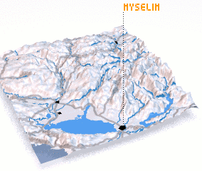 Places with similar names to Myselim, Albania ::
Disclaimer :: Information on this page comes without warranty of any kind |
||
|
Where is Myselim? Elevation and coordinates ::
Latitude (lat): 42°6'0"N Longitude (lon): 19°33'49"E
Elevation (approx.): 48m (map arrows pan, magnifying glasses zoom) |
||
|
Visiting Myselim? Hotel/Accommodation ::
Book a hotel in Myselim Travel Guide ::
Buy a travel guide for Albania rental cars ::
car rental offers GPS waypoint ::
download a GPX waypoint (PoI) of Myselim for your GPS receiver
|
||