|
search place name
|
||
Piraj (Lezhë, Albania)Piraj is a town in the Lezhë region of Albania. An overview map of the region around Piraj is displayed below.
regional and 3d topo map of Piraj, Albania ::

Piraj airports ::
The nearest airport is TIA - Tirana Rinas, located 50.1 km south of Piraj.
Other airports nearby include TGD - Podgorica (64.1 km north west), TIV - Tivat (97.3 km north west), OHD - Ohrid (118.8 km south east), DBV - Dubrovnik (137.8 km north west), Nearby towns ::
Gocaj (2.1km south west) //
Blinisht (2.3km north) //
Rraboshtë (3.3km south) //
Troshan (2.9km north east) //
Baqël (3.7km north) //
Kakarriq (3.0km west) //
(( Luk i Zi )) (3.5km south west) //
Fishtë (4.1km north east) //
Kallmeti i Madh (3.6km south east) //
Kodhel (4.7km north) //
Balldreni i Ri (4.9km south) //
Kallmeti i Vogël (4.1km east) //
Rrëza e Malit (5.3km south west) //
Merqi (6.0km south) //
Balldren (6.0km south) //
Krajn (5.8km north) //
Gjadër (5.0km north west) //
Dajç (6.9km north west) //
Nënshat (7.6km north) //
Sakës (7.5km south) //
Gjash (7.4km south east) //
Skataj (7.2km south west) //
Shëngjin (7.0km south west) //
Demaj (6.5km south west) //
Zojz (6.5km north west) //
Patalej (8.1km south) //
(( Varosh )) (8.5km south) //
Kotërr (8.4km north) //
Mali Shëngjinit (7.2km south west) //
[all distances 'as the bird flies' and approximate] 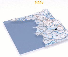 Places with similar names to Piraj, Albania ::
Disclaimer :: Information on this page comes without warranty of any kind |
||
|
Where is Piraj? Elevation and coordinates ::
Latitude (lat): 41°51'46"N Longitude (lon): 19°38'50"E
Elevation (approx.): 6m (map arrows pan, magnifying glasses zoom) |
||
|
Visiting Piraj? Hotel/Accommodation ::
Book a hotel in Piraj Travel Guide ::
Buy a travel guide for Albania rental cars ::
car rental offers GPS waypoint ::
download a GPX waypoint (PoI) of Piraj for your GPS receiver
|
||