|
search place name
|
||
Plan (Shkodër, Albania)Plan is a town in the Shkodër region of Albania. An overview map of the region around Plan is displayed below.
regional and 3d topo map of Plan, Albania ::

Plan airports ::
The nearest airport is TGD - Podgorica, located 37.0 km west of Plan.
Other airports nearby include TIV - Tivat (80.7 km west), TIA - Tirana Rinas (97.2 km south), PRN - Pristina (115.1 km east), DBV - Dubrovnik (120.9 km west), Nearby towns ::
Mëgullë (2.4km south) //
Pog (2.7km south) //
Gjuraj-Boks (2.5km west) //
Gjergoraj (4.7km south) //
Glac (4.7km south) //
Mirovne (4.7km south) //
Aljaj (5.0km south) //
Prencaj (5.4km south) //
Xhan (5.0km south west) //
Kir (5.9km south east) //
Kashec (6.4km south) //
Prangull (6.7km south) //
Lekgjonaj (6.6km south east) //
Alavane (6.3km south west) //
Bojaj (7.7km south) //
Krajë (8.1km south) //
Ducaj (7.2km north west) //
Ducaj (7.3km north west) //
Kocit (8.4km south) //
Lin (8.6km south) //
Pergjen (8.3km south west) //
Nicaj-Shosh (7.5km south east) //
Bruçaj (8.6km south west) //
Qilikok (7.9km south east) //
Kaprejë (8.8km north east) //
Makaj (7.9km north west) //
Martindrejaj (9.3km south west) //
[all distances 'as the bird flies' and approximate] 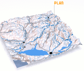 Places with similar names to Plan, Albania ::
Disclaimer :: Information on this page comes without warranty of any kind |
||
|
Where is Plan? Elevation and coordinates ::
Latitude (lat): 42°17'22"N Longitude (lon): 19°41'25"E
Elevation (approx.): 692m (map arrows pan, magnifying glasses zoom) |
||
|
Visiting Plan? Hotel/Accommodation ::
Book a hotel in Plan Travel Guide ::
Buy a travel guide for Albania rental cars ::
car rental offers GPS waypoint ::
download a GPX waypoint (PoI) of Plan for your GPS receiver
|
||