|
search place name
|
||
Rafija (Elbasan, Albania)Rafija is a town in the Elbasan region of Albania. An overview map of the region around Rafija is displayed below.
regional and 3d topo map of Rafija, Albania ::

Rafija airports ::
The nearest airport is OHD - Ohrid, located 40.6 km east of Rafija.
Other airports nearby include TIA - Tirana Rinas (62.0 km north west), KSO - Kastoria Aristotelis (107.9 km south east), SKP - Skopje (150.0 km north east), KZI - Kozani Filippos (156.8 km south east), Nearby towns ::
Sopot (2.3km south east) //
Vozjan (2.4km west) //
Vilan (3.2km north) //
Negrov (7.1km south) //
Gaferr (5.7km east) //
(( Breshkë )) (5.9km south east) //
Gurrëspate (7.5km north) //
Halilaj (8.1km south) //
Zavalinë (8.4km south) //
Shemat (8.1km south west) //
Sharë (7.1km north west) //
Pashtresh (7.7km south west) //
Polis-Gostimë (8.9km north) //
Sheh (8.9km north west) //
Manth (9.5km south west) //
Nezhan (9.9km south west) //
Xibresh (10.1km south west) //
[all distances 'as the bird flies' and approximate] 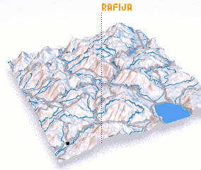 Places with similar names to Rafija, Albania ::
Disclaimer :: Information on this page comes without warranty of any kind |
||
|
Where is Rafija? Elevation and coordinates ::
Latitude (lat): 41°3'23"N Longitude (lon): 20°17'14"E
Elevation (approx.): 887m (map arrows pan, magnifying glasses zoom) |
||
|
Visiting Rafija? Hotel/Accommodation ::
Book a hotel in Rafija Travel Guide ::
Buy a travel guide for Albania rental cars ::
car rental offers GPS waypoint ::
download a GPX waypoint (PoI) of Rafija for your GPS receiver
|
||