|
search place name
|
||
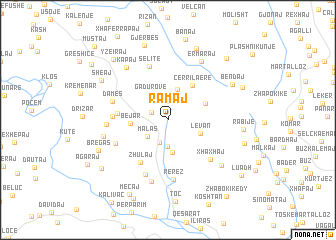
Ramaj (Fier, Albania)Ramaj is a town in the Fier region of Albania. An overview map of the region around Ramaj is displayed below.
regional and 3d topo map of Ramaj, Albania ::
Ramaj airports ::
The nearest airport is CFU - Kerkyra/corfu Ioannis Kapodistrias Intl, located 99.0 km south of Ramaj.
Other airports nearby include TIA - Tirana Rinas (103.1 km north), OHD - Ohrid (106.1 km north east), KSO - Kastoria Aristotelis (120.1 km east), IOA - Ioannina (120.3 km south east), Nearby towns ::
Ninësh (1.6km north west) //
Llakaj (2.6km south) //
Malas (2.5km south west) //
(( Kalemaj )) (3.0km south) //
Gadurovë (3.2km north west) //
Cërrilë (3.6km north) //
Krahësi i Sipërm (3.7km south) //
Levan (3.1km south east) //
Bejar (3.2km west) //
Allkomenaj (3.6km north east) //
Cërrila e Re (4.3km north east) //
Zhulaj (5.3km south west) //
(( Fratar )) (4.3km west) //
Tatoshaj (4.8km west) //
Manaj (5.1km south west) //
Selitë (6.2km north) //
Xhaxhaj (5.7km south east) //
Damës (5.2km north west) //
Krahës (6.4km south) //
Rerëz (6.6km south) //
Zaimaj (5.3km west) //
Lulëzim (7.0km south) //
Kapaj (6.8km north west) //
Zhupanar (5.8km west) //
Ermaraj (7.2km north east) //
Kamçisht (6.8km south east) //
Bendaj (6.8km north east) //
Bregas (6.8km south west) //
Rabije (6.5km east) //
[all distances 'as the bird flies' and approximate] 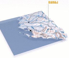 Places with similar names to Ramaj, Albania ::
Disclaimer :: Information on this page comes without warranty of any kind |
||
|
Where is Ramaj? Elevation and coordinates ::
Latitude (lat): 40°29'36"N Longitude (lon): 19°52'1"E
Elevation (approx.): 451m (map arrows pan, magnifying glasses zoom) |
||
|
Visiting Ramaj? Hotel/Accommodation ::
Book a hotel in Ramaj Travel Guide ::
Buy a travel guide for Albania rental cars ::
car rental offers GPS waypoint ::
download a GPX waypoint (PoI) of Ramaj for your GPS receiver
|
||