|
search place name
|
||
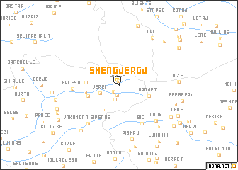
Shëngjergj (Tiranë, Albania)Shëngjergj is a town in the Tiranë region of Albania. An overview map of the region around Shëngjergj is displayed below.
regional and 3d topo map of Shëngjergj, Albania ::
Shëngjergj airports ::
The nearest airport is TIA - Tirana Rinas, located 34.0 km west of Shëngjergj.
Other airports nearby include OHD - Ohrid (55.4 km east), TGD - Podgorica (134.3 km north west), KSO - Kastoria Aristotelis (139.5 km south east), SKP - Skopje (143.5 km north east), Nearby towns ::
Skrep (0.7km north) //
Vërri (1.2km south west) //
Ruç (1.6km south) //
Urë (2.2km south) //
Verri (2.5km south west) //
Varros (4.1km south west) //
Panjet (3.9km south east) //
Shëngjini i Madh (4.0km south west) //
Burimas (4.0km west) //
(( Shënmëri )) (4.2km west) //
Biç (6.5km south east) //
Façesh (5.5km west) //
Vakumona i Sipërme (7.1km south west) //
Rinas (7.1km south east) //
Pishaj (8.6km south) //
Gjorkaj (8.0km south east) //
Val (8.4km north east) //
Vakumonë (8.4km south west) //
Ballgjin (7.3km south east) //
Gurakuq (7.9km south east) //
Lenaj (8.8km north east) //
Vërri (9.0km south east) //
Lukaxhi (10.0km south east) //
[all distances 'as the bird flies' and approximate] 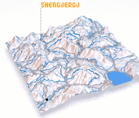 Places with similar names to Shëngjergj, Albania ::
Disclaimer :: Information on this page comes without warranty of any kind |
||
|
Where is Shëngjergj? Elevation and coordinates ::
Latitude (lat): 41°20'10"N Longitude (lon): 20°6'50"E
Elevation (approx.): 1042m (map arrows pan, magnifying glasses zoom) |
||
|
Visiting Shëngjergj? Hotel/Accommodation ::
Book a hotel in Shëngjergj Travel Guide ::
Buy a travel guide for Albania rental cars ::
car rental offers GPS waypoint ::
download a GPX waypoint (PoI) of Shëngjergj for your GPS receiver
|
||