|
search place name
|
||
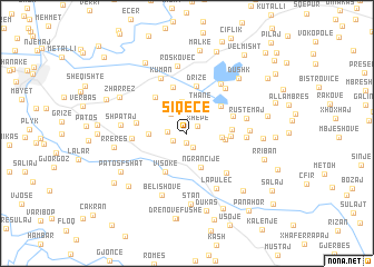
Siqecë (Fier, Albania)Siqecë is a town in the Fier region of Albania. An overview map of the region around Siqecë is displayed below.
regional and 3d topo map of Siqecë, Albania ::
Siqecë airports ::
The nearest airport is TIA - Tirana Rinas, located 81.9 km north of Siqecë.
Other airports nearby include OHD - Ohrid (103.3 km north east), CFU - Kerkyra/corfu Ioannis Kapodistrias Intl (120.6 km south), KSO - Kastoria Aristotelis (135.5 km east), LCC - Lecce (142.3 km west), Nearby towns ::
Ymeraj (0.9km south) //
Xhepë (1.1km north east) //
Ruzhdie (1.2km south west) //
Ruzhdijë (1.2km south west) //
Gjinoqarë (1.5km south) //
Shkëmber (1.5km west) //
Gerger (2.4km north) //
Bregas (2.3km north west) //
Luar (2.7km north) //
Thanë (3.1km north) //
Merikaj (3.2km north) //
Drenie (2.7km east) //
Ngrançije (3.6km south) //
Rusinjë (2.9km west) //
Benkollarët (3.0km east) //
Çerven (3.8km north east) //
Nuraj (3.4km east) //
Visokë (4.2km south west) //
Lazaj (3.5km east) //
Shushejt (4.4km north west) //
Vidhishtë (4.8km north) //
Drizë (4.8km north) //
Mbërs (3.9km north east) //
Kuqar (4.0km west) //
Margëlliç (4.2km west) //
Lofkënd (5.0km south east) //
Kurjan (5.4km north east) //
Hoxhë (4.6km east) //
Gegollarët (5.6km north east) //
[all distances 'as the bird flies' and approximate]  Places with similar names to Siqecë, Albania ::
Disclaimer :: Information on this page comes without warranty of any kind |
||
|
Where is Siqecë? Elevation and coordinates ::
Latitude (lat): 40°40'37"N Longitude (lon): 19°42'38"E
Elevation (approx.): 269m (map arrows pan, magnifying glasses zoom) |
||
|
Visiting Siqecë? Hotel/Accommodation ::
Book a hotel in Siqecë Travel Guide ::
Buy a travel guide for Albania rental cars ::
car rental offers GPS waypoint ::
download a GPX waypoint (PoI) of Siqecë for your GPS receiver
|
||