|
search place name
|
||
Smollik (Dibër, Albania)Smollik is a town in the Dibër region of Albania. An overview map of the region around Smollik is displayed below.
regional and 3d topo map of Smollik, Albania ::

Smollik airports ::
The nearest airport is OHD - Ohrid, located 40.9 km south east of Smollik.
Other airports nearby include TIA - Tirana Rinas (57.9 km west), SKP - Skopje (115.6 km north east), KSO - Kastoria Aristotelis (133.5 km south east), PRN - Pristina (134.9 km north), Nearby towns ::
Kojavec (1.5km south east) //
(( Murataj )) (2.1km south west) //
Lejçan (2.7km south) //
Lubalesh (2.9km north east) //
Tërnova e Vogël (2.7km south west) //
Stojka (3.8km south west) //
Kosovec (3.9km north) //
Strikçan (4.5km north) //
Orzhanovë (4.6km south east) //
Kurtaj (4.4km south west) //
Ostreni i Math (4.3km south east) //
Izvir (4.6km north east) //
Okshtuni i Madh (5.4km south) //
Sopot (5.5km north) //
Mallakastër (5.6km north) //
Tërnova e Madhe (4.6km west) //
Greshnjë (6.0km south west) //
Ballaj (6.6km south) //
Radovesh (5.1km east) //
Çerenec i Epërm (6.8km north) //
Moglicë (7.0km south) //
Sebisht (7.3km south) //
Viçisht (6.5km north east) //
Golovisht (6.4km north east) //
Çerenec i Poshtëm (7.5km north) //
Tërbaç (6.2km north east) //
Sofraçan (7.8km north) //
Zerqan (7.2km north west) //
Pasinkë (6.4km east) //
[all distances 'as the bird flies' and approximate] 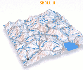 Places with similar names to Smollik, Albania ::
Disclaimer :: Information on this page comes without warranty of any kind |
||
|
Where is Smollik? Elevation and coordinates ::
Latitude (lat): 41°27'2"N Longitude (lon): 20°24'42"E
Elevation (approx.): 716m (map arrows pan, magnifying glasses zoom) |
||
|
Visiting Smollik? Hotel/Accommodation ::
Book a hotel in Smollik Travel Guide ::
Buy a travel guide for Albania rental cars ::
car rental offers GPS waypoint ::
download a GPX waypoint (PoI) of Smollik for your GPS receiver
|
||