|
search place name
|
||
Trojës (Lezhë, Albania)Trojës is a town in the Lezhë region of Albania. An overview map of the region around Trojës is displayed below.
regional and 3d topo map of Trojës, Albania ::

Trojës airports ::
The nearest airport is TIA - Tirana Rinas, located 44.0 km south west of Trojës.
Other airports nearby include TGD - Podgorica (87.8 km north west), OHD - Ohrid (92.6 km south east), TIV - Tivat (124.1 km north west), PRN - Pristina (126.2 km north east), Nearby towns ::
Tenë (2.3km north) //
Prosek (2.6km south) //
Përlati i Epërm (2.5km south east) //
Malaj (3.4km north east) //
Tharr (3.7km south east) //
(( Bungaj )) (3.3km west) //
Perlat-Qendër (4.5km south) //
Rrethas (3.6km east) //
Seresht (5.8km north) //
Ndreaj (5.2km south east) //
(( Lek Gegaj )) (6.2km south) //
Shebë (4.9km east) //
Kodër-Rrëshen (5.0km west) //
Gëziq (5.9km north west) //
Rrushkull (6.0km south west) //
(( Vale )) (6.4km north east) //
Tarazh (5.5km west) //
Jezull (6.0km west) //
Shtrez (7.6km south west) //
Vilëz (7.3km north east) //
Ndërfanë (7.1km north west) //
Ndërfushaz (6.6km west) //
Zall (8.4km north) //
Perlikaj (7.0km south east) //
Sheshaj (7.0km south west) //
Laç (9.2km south) //
Bruç (9.4km south east) //
Trojë (8.8km north east) //
Ujë (9.0km south west) //
[all distances 'as the bird flies' and approximate] 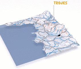 Places with similar names to Trojës, Albania ::
Disclaimer :: Information on this page comes without warranty of any kind |
||
|
Where is Trojës? Elevation and coordinates ::
Latitude (lat): 41°46'7"N Longitude (lon): 19°57'24"E
Elevation (approx.): 306m (map arrows pan, magnifying glasses zoom) |
||
|
Visiting Trojës? Hotel/Accommodation ::
Book a hotel in Trojës Travel Guide ::
Buy a travel guide for Albania rental cars ::
car rental offers GPS waypoint ::
download a GPX waypoint (PoI) of Trojës for your GPS receiver
|
||