|
search place name
|
||
Velahovë (Vlorë, Albania)Velahovë is a town in the Vlorë region of Albania. An overview map of the region around Velahovë is displayed below.
regional and 3d topo map of Velahovë, Albania ::

Velahovë airports ::
The nearest airport is CFU - Kerkyra/corfu Ioannis Kapodistrias Intl, located 39.2 km south west of Velahovë.
Other airports nearby include IOA - Ioannina (61.9 km east), KSO - Kastoria Aristotelis (113.7 km north east), PVK - Preveza Aktio (120.7 km south east), KZI - Kozani Filippos (150.2 km east), Nearby towns ::
Livinë (2.0km south west) //
Bistricë (2.3km north west) //
Krongj (2.2km north east) //
Navaricë (3.1km south) //
Sirakat (3.4km north) //
Brailat (3.5km north west) //
Pecë (4.0km north east) //
Ardhasovë (3.8km south west) //
Kardhikaq (5.5km north) //
Rumanxë (5.6km south west) //
Memoraq (6.1km south) //
Fitore (5.5km south west) //
Kostar (5.3km north west) //
Mesopotam (5.1km west) //
Muzinë (5.6km north east) //
Krane (5.4km west) //
Dërmish (7.2km south) //
Dhrovian (5.8km east) //
(( Dhrovjan i Poshtër )) (5.8km east) //
Dhivër (7.5km south) //
Rahullë (7.0km south west) //
Delvinë (7.1km north west) //
Piadhage (6.7km north west) //
Tremul (6.9km south west) //
(( Dhrovjan i Sipërm )) (6.6km east) //
Çlirim (6.7km west) //
Jermë (8.2km south west) //
Vllahat (7.4km north west) //
Kakodhiq (8.7km north west) //
[all distances 'as the bird flies' and approximate] 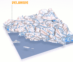 Places with similar names to Velahovë, Albania ::
Disclaimer :: Information on this page comes without warranty of any kind |
||
|
Where is Velahovë? Elevation and coordinates ::
Latitude (lat): 39°54'9"N Longitude (lon): 20°9'5"E
Elevation (approx.): 326m (map arrows pan, magnifying glasses zoom) |
||
|
Visiting Velahovë? Hotel/Accommodation ::
Book a hotel in Velahovë Travel Guide ::
Buy a travel guide for Albania rental cars ::
car rental offers GPS waypoint ::
download a GPX waypoint (PoI) of Velahovë for your GPS receiver
|
||