|
search place name
|
||
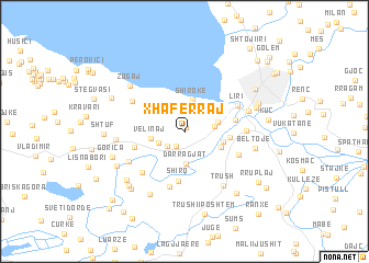
Xhaferraj (Shkodër, Albania)Xhaferraj is a town in the Shkodër region of Albania. An overview map of the region around Xhaferraj is displayed below.
regional and 3d topo map of Xhaferraj, Albania ::
Xhaferraj airports ::
The nearest airport is TGD - Podgorica, located 40.2 km north west of Xhaferraj.
Other airports nearby include TIA - Tirana Rinas (71.9 km south), TIV - Tivat (73.0 km north west), DBV - Dubrovnik (113.9 km north west), OHD - Ohrid (143.2 km south east), Nearby towns ::
Oblika e Sipërme (0.5km north) //
Oblika e Madhe (1.6km south west) //
Obot (1.9km south west) //
Shullan (2.2km south west) //
Zues (2.3km east) //
Darragjat (3.2km south) //
Shirokë (3.3km north) //
Dramosh (2.9km north west) //
Canaj (2.7km east) //
Velinaj (2.7km west) //
Bërdica e Madhe (3.1km south east) //
(( Bërdicë e Poshtme )) (3.1km east) //
Vallas (3.7km north west) //
Bërdica e Mesme (3.4km east) //
Shirq (5.0km south) //
Bahçallëk (4.0km east) //
Muriqan (4.1km west) //
Mushan (5.7km south) //
Mali Hebaj (4.7km south east) //
Dajç (5.2km south west) //
Liri (4.8km north east) //
Babot (5.0km north west) //
Bërdica e Sipërme (4.7km east) //
Samrisht (5.2km south west) //
Tabak Ajasmë (5.2km north east) //
Trush (6.2km south east) //
Dodaj (5.3km west) //
Zogaj (6.2km north west) //
Suk-Dajç (6.9km south west) //
[all distances 'as the bird flies' and approximate]  Places with similar names to Xhaferraj, Albania ::
// Xhaferraj (AL)
Disclaimer :: Information on this page comes without warranty of any kind |
||
|
Where is Xhaferraj? Elevation and coordinates ::
Latitude (lat): 42°1'44"N Longitude (lon): 19°26'57"E
Elevation (approx.): 43m (map arrows pan, magnifying glasses zoom) |
||
|
Visiting Xhaferraj? Hotel/Accommodation ::
Book a hotel in Xhaferraj Travel Guide ::
Buy a travel guide for Albania rental cars ::
car rental offers GPS waypoint ::
download a GPX waypoint (PoI) of Xhaferraj for your GPS receiver
|
||