|
search place name
|
||
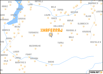
Xhaferraj (Kukës, Albania)Xhaferraj is a town in the Kukës region of Albania. An overview map of the region around Xhaferraj is displayed below.
regional and 3d topo map of Xhaferraj, Albania ::
Xhaferraj airports ::
The nearest airport is PRN - Pristina, located 79.2 km north east of Xhaferraj.
Other airports nearby include OHD - Ohrid (89.7 km south), TIA - Tirana Rinas (90.9 km south west), SKP - Skopje (91.1 km east), TGD - Podgorica (113.5 km north west), Nearby towns ::
Topojan (1.6km north) //
Brekijë (2.6km north) //
Shtrezë (2.2km north east) //
Kollovoz (3.6km north east) //
Turaj (4.0km south east) //
Nimçë (5.0km north) //
Nimçë (5.8km north) //
Tërshenë (4.8km west) //
Oreshkë (5.7km north east) //
Cërnalevë (6.7km north) //
Lojme (7.0km north) //
Buzëmadhe (6.0km south west) //
Novoselë (5.6km east) //
Balë (5.6km east) //
Orçikël (8.1km north) //
Borje (7.3km north east) //
Kosharisht (9.4km north east) //
Orgjost (9.2km north east) //
Shkinak (9.8km south west) //
Fshat (9.4km south west) //
Orčuša (10.2km north east) //
[all distances 'as the bird flies' and approximate]  Places with similar names to Xhaferraj, Albania ::
// Xhaferraj (AL)
Disclaimer :: Information on this page comes without warranty of any kind |
||
|
Where is Xhaferraj? Elevation and coordinates ::
Latitude (lat): 41°58'13"N Longitude (lon): 20°31'20"E
Elevation (approx.): 1205m (map arrows pan, magnifying glasses zoom) |
||
|
Visiting Xhaferraj? Hotel/Accommodation ::
Book a hotel in Xhaferraj Travel Guide ::
Buy a travel guide for Albania rental cars ::
car rental offers GPS waypoint ::
download a GPX waypoint (PoI) of Xhaferraj for your GPS receiver
|
||