|
search place name
|
||
Zvërnec (Vlorë, Albania)Zvërnec is a town in the Vlorë region of Albania. An overview map of the region around Zvërnec is displayed below.
regional and 3d topo map of Zvërnec, Albania ::

Zvërnec airports ::
The nearest airport is TIA - Tirana Rinas, located 103.1 km north of Zvërnec.
Other airports nearby include CFU - Kerkyra/corfu Ioannis Kapodistrias Intl (109.8 km south east), LCC - Lecce (113.2 km west), BDS - Brindisi Casale (125.4 km west), OHD - Ohrid (133.9 km north east), Nearby towns ::
Zvemec (NaNkm north) //
Nartë (3.8km south east) //
(( Goricë )) (4.2km east) //
Panaja (5.3km north east) //
Bestrovë (5.7km east) //
Hoshtimë (6.5km north east) //
Skrofotinë (7.7km north east) //
Cerkovinë (8.0km north east) //
Vlorë (8.2km south east) //
[all distances 'as the bird flies' and approximate] 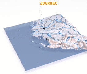 Places with similar names to Zvërnec, Albania ::
// Zverinka (RU)
// Sievering (AT)
// Soffranco (IT)
// Safronka (PL)
// Zvornik (BA)
// Svay Riĕng (KH)
// Seforong (LS)
// Zvěřínek (CZ)
// Xã Phú Riềng (VN)
// Savernake (AU)
Disclaimer :: Information on this page comes without warranty of any kind |
||
|
Where is Zvërnec? Elevation and coordinates ::
Latitude (lat): 40°30'55"N Longitude (lon): 19°25'1"E
Elevation (approx.): 28m (map arrows pan, magnifying glasses zoom) |
||
|
Visiting Zvërnec? Hotel/Accommodation ::
Book a hotel in Zvërnec Travel Guide ::
Buy a travel guide for Albania rental cars ::
car rental offers GPS waypoint ::
download a GPX waypoint (PoI) of Zvërnec for your GPS receiver
|
||