|
search place name
|
||
Cerik (Bosnia and Herzegovina)Cerik is a town in Bosnia and Herzegovina. An overview map of the region around Cerik is displayed below.
regional and 3d topo map of Cerik, Bosnia and Herzegovina ::

Cerik airports ::
The nearest airport is OSI - Osijek, located 76.1 km north of Cerik.
Other airports nearby include SJJ - Sarajevo (110.3 km south), BEG - Beograd (140.7 km east), OMO - Mostar (178.0 km south), Nearby towns ::
Hrgovi Donji (0.9km south west) //
Gornja Mahala (1.1km south west) //
Donja Mahala (1.4km south) //
Jakeš (1.6km south west) //
Kerepi (1.5km east) //
Cvijanovići (2.2km south east) //
Brđani (2.9km south east) //
Mijatovići (3.5km north east) //
Bosanska Bijela (3.1km south east) //
Bijeli Potok (3.6km south east) //
Donja Mahala (2.9km west) //
Avramovina (3.6km north west) //
Hrgovi Gornji (4.2km south) //
Lukići (4.1km north) //
Potočari (4.1km north east) //
Vučkovci (3.1km west) //
Maksići (3.8km north east) //
Sljivići (3.3km east) //
Gornja Mahala (3.3km west) //
Porebrice (4.3km north) //
Seljani (3.3km east) //
Guderevica (3.7km north east) //
Grabov Gaj (4.8km north) //
Donje Gušte (4.2km south west) //
Lomnica (4.9km north) //
Ðukići (4.8km north west) //
Brdo (5.4km north) //
Donja Mionica (5.3km north west) //
Gornje Gušte (4.6km south west) //
[all distances 'as the bird flies' and approximate] 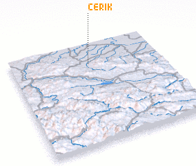 Places with similar names to Cerik, Bosnia and Herzegovina ::
Disclaimer :: Information on this page comes without warranty of any kind |
||
|
Where is Cerik? Elevation and coordinates ::
Latitude (lat): 44°48'25"N Longitude (lon): 18°31'49"E
Elevation (approx.): 159m (map arrows pan, magnifying glasses zoom) |
||
|
Visiting Cerik? Hotel/Accommodation ::
Book a hotel in Cerik Travel Guide ::
rental cars ::
car rental offers GPS waypoint ::
download a GPX waypoint (PoI) of Cerik for your GPS receiver
|
||