|
search place name
|
||
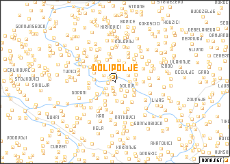
Dolipolje (Federacija Bosne i Hercegovine, Bosnia and Herzegovina)Dolipolje is a town in the Federacija Bosne i Hercegovine region of Bosnia and Herzegovina. An overview map of the region around Dolipolje is displayed below.
regional and 3d topo map of Dolipolje, Bosnia and Herzegovina ::
Dolipolje airports ::
The nearest airport is SJJ - Sarajevo, located 20.4 km south east of Dolipolje.
Other airports nearby include OMO - Mostar (83.4 km south), DBV - Dubrovnik (158.3 km south), SPU - Split (161.7 km west), OSI - Osijek (170.9 km north), Nearby towns ::
Čekrčići (0.7km north) //
Kuti (0.7km north west) //
Krčevine (1.0km south) //
Vrela (0.9km west) //
Kula Banjer (1.0km north west) //
Smreke (1.5km south) //
Banjer (1.5km south east) //
Kopači (1.8km north) //
Plješevica (1.5km south west) //
Huma (1.9km south) //
Kula (1.7km north west) //
Odžaci (1.9km north east) //
Isakovići (2.4km north) //
Čifluk (1.8km east) //
Kučini (2.3km south west) //
Dolovi (2.1km south east) //
Zbilje (2.2km south west) //
Lisak (2.7km north) //
Breznići (2.6km south east) //
Donja Vratnica (2.6km north east) //
Dobre (3.1km south) //
Oblaci (2.8km north east) //
Lješevo (2.4km east) //
Ljubnići (2.6km south east) //
Gornja Vratnica (3.2km north) //
Stuparići (3.2km south) //
Visoko (2.5km west) //
Vlajčići (3.4km south) //
Oštroc (2.9km south west) //
[all distances 'as the bird flies' and approximate]  Places with similar names to Dolipolje, Bosnia and Herzegovina ::
Disclaimer :: Information on this page comes without warranty of any kind |
||
|
Where is Dolipolje? Elevation and coordinates ::
Latitude (lat): 43°59'7"N Longitude (lon): 18°12'32"E
Elevation (approx.): 496m (map arrows pan, magnifying glasses zoom) |
||
|
Visiting Dolipolje? Hotel/Accommodation ::
Book a hotel in Dolipolje Travel Guide ::
rental cars ::
car rental offers GPS waypoint ::
download a GPX waypoint (PoI) of Dolipolje for your GPS receiver
|
||