|
search place name
|
||
Kladanj (Federacija Bosne i Hercegovine, Bosnia and Herzegovina)Kladanj is a town in the Federacija Bosne i Hercegovine region of Bosnia and Herzegovina. An overview map of the region around Kladanj is displayed below.
regional and 3d topo map of Kladanj, Bosnia and Herzegovina ::

Kladanj airports ::
The nearest airport is SJJ - Sarajevo, located 53.2 km south west of Kladanj.
Other airports nearby include OMO - Mostar (125.0 km south west), OSI - Osijek (137.7 km north), BEG - Beograd (144.5 km north east), DBV - Dubrovnik (188.1 km south), Nearby towns ::
Buševo (1.1km north west) //
Vitalj (1.8km north east) //
Plahovići (1.6km north west) //
(( Vranovići )) (2.2km south west) //
Mladovo (3.1km north) //
Vučinići (2.5km south east) //
Kovačići (3.4km south) //
Vranovići (3.2km north west) //
Gojsalići (3.1km north east) //
Puljići (3.5km south east) //
Malovčići (4.5km north) //
Konjevići (4.4km south east) //
Plaša (4.5km north west) //
Svinje Brdo (4.9km north west) //
Vranovići (5.0km north west) //
Imamovići (4.1km east) //
Velika Kula (5.8km south) //
Brateljevići (4.2km west) //
Stanišići (5.5km south east) //
Gojakovići (5.2km north east) //
Mala Kula (6.2km south) //
LjeskovaRavan (5.9km north west) //
Obrčevac (5.8km north west) //
Brlošci (6.6km north) //
Donji Olovci (6.8km north) //
Starič (5.1km east) //
Gornji Drecelj (7.3km south) //
Zagrađe (5.3km west) //
Stupčine (7.5km south) //
[all distances 'as the bird flies' and approximate] 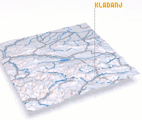 Places with similar names to Kladanj, Bosnia and Herzegovina ::
// Kaltanj (AL)
// Kola Donja (BA)
// Goāldāngi (BD)
// Gol Tangeh (IR)
// Gulotangi (PK)
// Kālu Tangi (PK)
// Glyttinge (SE)
// Käldinge (FI)
// Kaldanija (HR)
// Kloetinge (NL)
Disclaimer :: Information on this page comes without warranty of any kind |
||
|
Where is Kladanj? Elevation and coordinates ::
Latitude (lat): 44°13'35"N Longitude (lon): 18°41'29"E
Elevation (approx.): 564m (map arrows pan, magnifying glasses zoom) |
||
|
Visiting Kladanj? Hotel/Accommodation ::
Book a hotel in Kladanj Travel Guide ::
rental cars ::
car rental offers GPS waypoint ::
download a GPX waypoint (PoI) of Kladanj for your GPS receiver
|
||