|
search place name
|
||
Krnete (Federacija Bosne i Hercegovine, Bosnia and Herzegovina)Krnete is a town in the Federacija Bosne i Hercegovine region of Bosnia and Herzegovina. An overview map of the region around Krnete is displayed below.
regional and 3d topo map of Krnete, Bosnia and Herzegovina ::

Krnete airports ::
The nearest airport is SPU - Split, located 80.2 km south of Krnete.
Other airports nearby include ZAD - Zadar (81.2 km west), OMO - Mostar (162.8 km south east), ZAG - Zagreb (166.1 km north), SJJ - Sarajevo (166.8 km east), Nearby towns ::
Milijevići (0.5km north) //
Zebe (0.7km north west) //
Ðukclići (1.1km north west) //
Sabljići (1.6km north west) //
Mandići (1.7km south east) //
Majstorovići (1.9km north) //
Bursaći (2.3km south east) //
Jovandići (2.7km south east) //
Isjek (2.8km south east) //
Koturi (3.0km south west) //
Peći (3.2km south west) //
Jovandići (3.9km south) //
Jojići (3.7km south west) //
Ivanovići (2.9km west) //
Carići (3.1km west) //
Skakići (3.6km south east) //
Bobići (3.3km south west) //
Reljići (4.6km south) //
Jadovnik (3.5km east) //
Lukači (4.4km north west) //
Reljići (4.2km south east) //
Bilčari (4.1km south west) //
Zivlaci (4.9km north west) //
Kralji (4.6km south east) //
Resanovci (4.8km north west) //
Potkošani (5.6km south) //
Poljari (4.6km north west) //
Race (5.3km north west) //
Trivanov Do (5.6km south west) //
[all distances 'as the bird flies' and approximate] 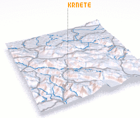 Places with similar names to Krnete, Bosnia and Herzegovina ::
Disclaimer :: Information on this page comes without warranty of any kind |
||
|
Where is Krnete? Elevation and coordinates ::
Latitude (lat): 44°15'38"N Longitude (lon): 16°20'24"E
Elevation (approx.): 827m (map arrows pan, magnifying glasses zoom) |
||
|
Visiting Krnete? Hotel/Accommodation ::
Book a hotel in Krnete Travel Guide ::
rental cars ::
car rental offers GPS waypoint ::
download a GPX waypoint (PoI) of Krnete for your GPS receiver
|
||