|
search place name
|
||
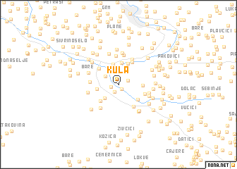
Kula (Federacija Bosne i Hercegovine, Bosnia and Herzegovina)Kula is a town in the Federacija Bosne i Hercegovine region of Bosnia and Herzegovina. An overview map of the region around Kula is displayed below.
regional and 3d topo map of Kula, Bosnia and Herzegovina ::
Kula airports ::
The nearest airport is SJJ - Sarajevo, located 46.9 km south east of Kula.
Other airports nearby include OMO - Mostar (90.9 km south), SPU - Split (142.5 km south west), OSI - Osijek (167.9 km north east), DBV - Dubrovnik (173.8 km south), Nearby towns ::
Krčevine (0.8km south) //
Busovača (1.0km south west) //
Carica (1.2km south west) //
Mejdani (1.2km north east) //
Skradno (2.2km north) //
Jazvine (2.0km north west) //
Bobovišće (2.4km north) //
Sajtovići (2.6km north west) //
Podjele (2.8km north) //
Ravan (2.7km south west) //
Kaonik (3.3km north) //
Strane (3.4km north) //
Buselji (2.6km west) //
Katići (3.5km north) //
Donje Polje (3.2km south east) //
Solakovići (2.8km east) //
Kupres (3.3km south west) //
Granice (3.4km north west) //
Merdani (3.8km north east) //
Radenovići (3.8km south east) //
Milavice (3.3km south east) //
Bakije (4.5km north) //
Krnjače (3.3km west) //
Grablje (4.3km north) //
Dvorišta (4.2km south west) //
Dvor (4.7km north) //
Krvavičići (3.7km east) //
Odmeka (3.7km west) //
Putiš (5.0km north) //
[all distances 'as the bird flies' and approximate]  Places with similar names to Kula, Bosnia and Herzegovina ::
Disclaimer :: Information on this page comes without warranty of any kind |
||
|
Where is Kula? Elevation and coordinates ::
Latitude (lat): 44°6'3"N Longitude (lon): 17°53'24"E
Elevation (approx.): 454m (map arrows pan, magnifying glasses zoom) |
||
|
Visiting Kula? Hotel/Accommodation ::
Book a hotel in Kula Travel Guide ::
rental cars ::
car rental offers GPS waypoint ::
download a GPX waypoint (PoI) of Kula for your GPS receiver
|
||