|
search place name
|
||
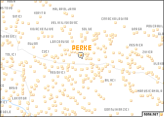
Perke (Federacija Bosne i Hercegovine, Bosnia and Herzegovina)Perke is a town in the Federacija Bosne i Hercegovine region of Bosnia and Herzegovina. An overview map of the region around Perke is displayed below.
regional and 3d topo map of Perke, Bosnia and Herzegovina ::
Perke airports ::
The nearest airport is OMO - Mostar, located 27.7 km south east of Perke.
Other airports nearby include SJJ - Sarajevo (79.7 km north east), SPU - Split (101.8 km west), DBV - Dubrovnik (110.1 km south east), TIV - Tivat (146.4 km south east), Nearby towns ::
Cigići (0.7km east) //
Ćoše (1.2km north east) //
Dobrkovići (1.1km north east) //
Šakote (1.4km north west) //
Ćorći (1.2km east) //
Grbešići (1.4km north east) //
Solde (1.6km east) //
Šarića Dubrava (1.7km south west) //
Podastrana (2.0km north west) //
Sliškovići (1.9km south east) //
Pinjuhi (2.5km south) //
Dubrava (2.6km south) //
Galići (2.5km south) //
Jelići (2.3km south east) //
Ljubotići (2.4km north west) //
Jozići (2.5km south east) //
Kvesići (2.2km north west) //
Kraljevići (2.8km south west) //
Lovrići (2.6km south west) //
Zeljkina Glavica (2.4km north east) //
Pod Glavicom (3.1km north) //
Galići (2.7km south west) //
Privalj (2.9km south west) //
Zavoznik (3.4km south east) //
Trn (3.0km south east) //
Čerkezi (3.8km south) //
Galići (3.0km north west) //
Vukoje (2.9km north west) //
Oklaji (2.8km east) //
[all distances 'as the bird flies' and approximate]  Places with similar names to Perke, Bosnia and Herzegovina ::
Disclaimer :: Information on this page comes without warranty of any kind |
||
|
Where is Perke? Elevation and coordinates ::
Latitude (lat): 43°23'44"N Longitude (lon): 17°32'26"E
Elevation (approx.): 385m (map arrows pan, magnifying glasses zoom) |
||
|
Visiting Perke? Hotel/Accommodation ::
Book a hotel in Perke Travel Guide ::
rental cars ::
car rental offers GPS waypoint ::
download a GPX waypoint (PoI) of Perke for your GPS receiver
|
||