|
search place name
|
||
Petačići (Federacija Bosne i Hercegovine, Bosnia and Herzegovina)Petačići is a town in the Federacija Bosne i Hercegovine region of Bosnia and Herzegovina. An overview map of the region around Petačići is displayed below.
regional and 3d topo map of Petačići, Bosnia and Herzegovina ::

Petačići airports ::
The nearest airport is SJJ - Sarajevo, located 65.2 km south east of Petačići.
Other airports nearby include OMO - Mostar (96.0 km south), SPU - Split (126.6 km south west), OSI - Osijek (174.3 km north east), DBV - Dubrovnik (182.0 km south), Nearby towns ::
Basalići (0.5km east) //
Zakučke (1.1km north) //
Turalići (1.2km south east) //
Pečuj (1.9km north east) //
Potočani (1.6km north east) //
Čosići (1.6km east) //
Božići (2.7km south) //
Čelipići (2.0km west) //
Torine (2.3km north west) //
Zubići (2.9km north east) //
Šenkovići (2.5km west) //
Margetići (3.4km north) //
Reput (3.6km south) //
Bistro (3.3km south east) //
Bugojčići (2.9km north east) //
Rastovci (3.5km north east) //
Kopila (2.9km west) //
Opara (4.0km south) //
Hadžići (3.6km north west) //
Duboko (3.0km east) //
Potok (3.4km north west) //
Rudno (3.1km east) //
Zenepići (3.9km north west) //
Isakovići (4.4km north) //
Kasapovići (4.4km north) //
Sinokos (3.4km north west) //
Novi Travnik (4.4km north) //
Glavenčić (3.4km west) //
Bukvići (3.6km north west) //
[all distances 'as the bird flies' and approximate] 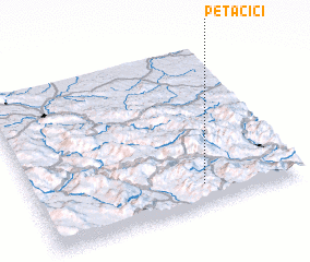 Places with similar names to Petačići, Bosnia and Herzegovina ::
// Pito Aceso (BR)
// Patsós (GR)
// Piedosas (PT)
// Potasze (PL)
// Putišići (BA)
// Pʼitsʼesi (GE)
// Poétsaysay (VU)
Disclaimer :: Information on this page comes without warranty of any kind |
||
|
Where is Petačići? Elevation and coordinates ::
Latitude (lat): 44°8'1"N Longitude (lon): 17°38'24"E
Elevation (approx.): 757m (map arrows pan, magnifying glasses zoom) |
||
|
Visiting Petačići? Hotel/Accommodation ::
Book a hotel in Petačići Travel Guide ::
rental cars ::
car rental offers GPS waypoint ::
download a GPX waypoint (PoI) of Petačići for your GPS receiver
|
||