|
search place name
|
||
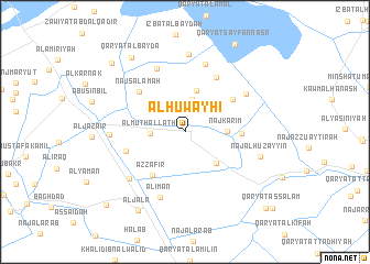
Al Ḩuwayḩī (Al Buḩayrah, Egypt)Al Ḩuwayḩī is a town in the Al Buḩayrah region of Egypt. An overview map of the region around Al Ḩuwayḩī is displayed below.
regional and 3d topo map of Al Ḩuwayḩī, Egypt ::
Al Ḩuwayḩī airports ::
The nearest airport is ALY - Alexandria Intl, located 26.3 km north of Al Ḩuwayḩī.
Other airports nearby include CAI - Cairo Intl (169.4 km south east), Nearby towns ::
Ţībah Raqm Ithnayn (3.3km north) //
Al Muthallath (3.0km west) //
Naj‘ Karīm (3.7km east) //
Al Ḩāris Raqm Thalāthah (4.3km north) //
An Nāşir (4.2km south east) //
Az̧ Z̧āfir (5.3km south west) //
Naj‘ ad Dabbābah (5.0km east) //
Al Misayrī Raqm Ithnayn (5.3km north east) //
Naj‘ Salāmah (5.7km north west) //
Māryūbūlīs (5.5km west) //
Al Ḩāris Raqm Sittah (6.1km north east) //
Qaryat al Waqqād (6.8km north) //
Al Īmān (7.0km south) //
Qaryat as Salām (7.1km north) //
Al Misayrī Raqm Wāḩid (6.5km north east) //
Al Qāhir (6.8km south west) //
Al ‘Izzah (6.5km west) //
Qaryat Sanad Raqm Ithnayn (7.9km north) //
Naj‘ al Ḩuzayyin (7.1km east) //
Al Jalāʼ (8.9km south west) //
Qaryat al Bayḑā (8.8km north west) //
Naj‘ al Hawīs (9.4km north west) //
Al Ḩurrīyah (10.1km south west) //
As Salām (10.5km south east) //
Qaryat as Salām (10.9km south east) //
[all distances 'as the bird flies' and approximate]  Places with similar names to Al Ḩuwayḩī, Egypt :: Disclaimer :: Information on this page comes without warranty of any kind |
||
|
Where is Al Ḩuwayḩī? Elevation and coordinates ::
Latitude (lat): 30°56'52"N Longitude (lon): 29°55'15"E
Elevation (approx.): 6m (map arrows pan, magnifying glasses zoom) |
||
|
Visiting Al Ḩuwayḩī? Hotel/Accommodation ::
Book a hotel in Al Ḩuwayḩī Travel Guide ::
Buy a travel guide for Egypt rental cars ::
car rental offers GPS waypoint ::
download a GPX waypoint (PoI) of Al Ḩuwayḩī for your GPS receiver
|
||