|
search place name
|
||
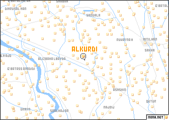
Al Kurdī (Kafr ash Shaykh, Egypt)Al Kurdī is a town in the Kafr ash Shaykh region of Egypt. An overview map of the region around Al Kurdī is displayed below.
regional and 3d topo map of Al Kurdī, Egypt ::
Al Kurdī airports ::
The nearest airport is ALY - Alexandria Intl, located 83.5 km west of Al Kurdī.
Other airports nearby include CAI - Cairo Intl (120.1 km south east), PSD - Port Said (137.7 km east), Nearby towns ::
‘Izbat al Ḩinnāwī (1.0km south east) //
Quzmān (1.3km west) //
‘Izbat ‘Abd al Fattāḩ al Lam‘ī (1.9km east) //
Nashart (2.1km north east) //
Kafr Yūsuf Dāwūd (2.5km north) //
‘Izbat Muḩammad Ismā‘īl (2.3km east) //
‘Izbat al Ḩajar (2.4km north west) //
‘Izbat ad Daramallī (2.6km south east) //
‘Izbat Shāhīn (2.8km north east) //
Al Bakātūsh (2.9km south west) //
Kafr Yūsuf Ḩinnis (3.2km north) //
‘Izbat Ḩasan Yakan (3.0km south east) //
Taftīsh Awqāf Qallīn (3.2km south east) //
Ţawīlat Nashart (3.3km north east) //
Shabās ‘Umayyir (3.2km north west) //
‘Izbat Kawm Bilaydah (3.0km west) //
Minyat Qallīn (3.6km south) //
Al Minshāt aş Şughrá (3.3km east) //
Kafr al Afandī (3.7km south east) //
‘Izbat Şalāḩ Shukrī (4.1km north) //
‘Izbat Ḩusayn al Khubī al Kubrá (4.4km north) //
‘Izbat Kafr Abū Ḩaţab (4.6km south) //
Minshāt ash Shādhlī (4.3km south west) //
Şarawah (4.7km south east) //
‘Izbat Muḩammad al Ḩalīm (4.8km north) //
‘Izbat Abū al Jadāyil (4.3km north east) //
‘Izbat Yūsuf ‘Ajlān (4.9km north west) //
‘Izbat an Nashū (5.1km north) //
‘Izbat ‘Alī Ibrāhīm (4.7km north east) //
[all distances 'as the bird flies' and approximate] 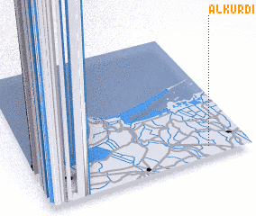 Places with similar names to Al Kurdī, Egypt ::
// Alegrete (BO)
// Alegrete (PT)
// Ålgård (NO)
// Ålgård (NO)
// Algorta (CU)
// Al Qarāḑah (EG)
// Alikurt (TR)
// Alguerdo (ES)
// Alakurtti (RU)
// Al Qurayyāt (SA)
Disclaimer :: Information on this page comes without warranty of any kind |
||
|
Where is Al Kurdī? Elevation and coordinates ::
Latitude (lat): 31°4'37"N Longitude (lon): 30°48'55"E
Elevation (approx.): 5m (map arrows pan, magnifying glasses zoom) |
||
|
Visiting Al Kurdī? Hotel/Accommodation ::
Book a hotel in Al Kurdī Travel Guide ::
Buy a travel guide for Egypt rental cars ::
car rental offers GPS waypoint ::
download a GPX waypoint (PoI) of Al Kurdī for your GPS receiver
|
||