|
search place name
|
||
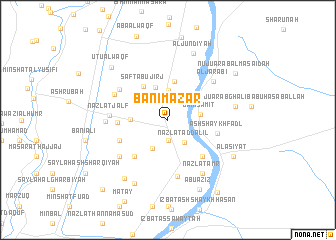
Banī Mazār (Al Minyā, Egypt)Banī Mazār is a town in the Al Minyā region of Egypt. An overview map of the region around Banī Mazār is displayed below.
regional and 3d topo map of Banī Mazār, Egypt ::
Banī Mazār airports ::
The nearest airport is CAI - Cairo Intl, located 188.8 km north of Banī Mazār.
Nearby towns ::
Al Manshīyah al Jadīdah (2.3km south) //
Nazlat ad Dalīl (3.0km south east) //
Al Mawaddah (3.3km north) //
Al Qays (3.5km south west) //
Banī Sāmiţ (3.3km east) //
Abū Jirj (3.8km north) //
Ţanbū (3.7km west) //
‘Izbat Ḩusayn ‘Abd ar Rāziq (4.3km north) //
Şafţ Abū Jirj (4.4km north west) //
As Sa‘dīyah (5.3km south west) //
Kafr ash Shaykh Ibrāhīm (5.3km south east) //
Minshāt Bakīr (5.0km west) //
Ash Shaykh Faḑl (5.1km east) //
Ibshāq al Ghazāl (5.3km south west) //
Kufūr aş Şūlīyah (6.3km south) //
Abţūjah (5.9km north west) //
Nazlat Jalf (5.7km west) //
Abū al ‘Abbās (6.0km north west) //
Al Jarābī‘ (6.2km north east) //
Nazlet Aulâd Dura (6.3km south west) //
Umm as Sās (6.2km west) //
Al Fārūqīyah (6.8km south east) //
Nazlat ‘Amr (6.8km south east) //
Ḩamāḑah (6.8km east) //
Al Jundīyah (7.8km north) //
Kawm Maţāy (7.8km south west) //
Al Atlāt (7.8km south west) //
Al ‘Aşīyāt (7.7km south east) //
Abū ‘Azīz (8.4km south) //
[all distances 'as the bird flies' and approximate]  Places with similar names to Banī Mazār, Egypt ::
Disclaimer :: Information on this page comes without warranty of any kind |
||
|
Where is Banī Mazār? Elevation and coordinates ::
Latitude (lat): 28°30'13"N Longitude (lon): 30°47'57"E
Elevation (approx.): 43m (map arrows pan, magnifying glasses zoom) |
||
|
Visiting Banī Mazār? Hotel/Accommodation ::
Book a hotel in Banī Mazār Travel Guide ::
Buy a travel guide for Egypt rental cars ::
car rental offers GPS waypoint ::
download a GPX waypoint (PoI) of Banī Mazār for your GPS receiver
|
||