|
search place name
|
||
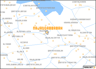
Naj‘ ad Dabbābah (Al Buḩayrah, Egypt)Naj‘ ad Dabbābah is a town in the Al Buḩayrah region of Egypt. An overview map of the region around Naj‘ ad Dabbābah is displayed below.
regional and 3d topo map of Naj‘ ad Dabbābah, Egypt ::
Naj‘ ad Dabbābah airports ::
The nearest airport is ALY - Alexandria Intl, located 26.5 km north of Naj‘ ad Dabbābah.
Other airports nearby include CAI - Cairo Intl (165.1 km south east), Nearby towns ::
Naj‘ Karīm (1.3km west) //
Naj‘ al Ḩuzayyin (2.9km south east) //
Al Misayrī Raqm Ithnayn (3.6km north) //
An Nāşir (3.7km south west) //
Al Misayrī Raqm Wāḩid (4.1km north) //
Al Ḩuwayḩī (5.0km west) //
‘Izbat al Manshīyah (5.6km south east) //
Ţībah Raqm Ithnayn (5.6km north west) //
Al Ḩāris Raqm Sittah (6.1km north) //
Al Ḩāris Raqm Thalāthah (5.9km north west) //
Naj‘ az Zu‘aytirah (5.9km east) //
Naj‘ al Quţţah (5.9km east) //
Al Mahdīyah (6.8km south east) //
As Salām (7.9km south) //
Qaryat as Salām (7.7km north west) //
Qaryat as Salām (8.0km south) //
‘Izbat Yūnis ‘Arqūb (7.7km east) //
Qaryat Sanad Raqm Ithnayn (9.3km north west) //
Al Īmān (9.6km south west) //
Qaryat al Waqqād (9.9km north west) //
[all distances 'as the bird flies' and approximate]  Places with similar names to Naj‘ ad Dabbābah, Egypt :: Disclaimer :: Information on this page comes without warranty of any kind |
||
|
Where is Naj‘ ad Dabbābah? Elevation and coordinates ::
Latitude (lat): 30°56'45"N Longitude (lon): 29°58'22"E
Elevation (approx.): -1m (map arrows pan, magnifying glasses zoom) |
||
|
Visiting Naj‘ ad Dabbābah? Hotel/Accommodation ::
Book a hotel in Naj‘ ad Dabbābah Travel Guide ::
Buy a travel guide for Egypt rental cars ::
car rental offers GPS waypoint ::
download a GPX waypoint (PoI) of Naj‘ ad Dabbābah for your GPS receiver
|
||