|
search place name
|
||
Dragotintsi (Bulgaria)Dragotintsi is a town in Bulgaria. An overview map of the region around Dragotintsi is displayed below.
regional and 3d topo map of Dragotintsi, Bulgaria ::

Dragotintsi airports ::
The nearest airport is SOF - Sofia, located 44.9 km east of Dragotintsi.
Other airports nearby include INI - Nis (100.9 km north west), SKP - Skopje (144.3 km south west), PRN - Pristina (155.8 km west), CRA - Craiova (181.6 km north east), Nearby towns ::
Povalirŭzh (1.9km south) //
Izvor (2.3km north east) //
Taban (3.7km north) //
Bakhalin (3.9km north) //
Tsatsarovtsi (3.3km north west) //
Radulovtsi (3.3km south east) //
Pishtane (4.6km south west) //
Bŭrlozhnitsa (4.1km east) //
Kambelevtsi (5.7km north) //
Chukovezer (6.0km north) //
Krasava (6.2km south west) //
Ozŭrnovtsi (6.2km south west) //
Gaber (6.3km north west) //
Gorni Romantsi (7.4km south) //
Yalbotina (5.7km west) //
Brusnik (5.7km west) //
Yarlovtsi (7.5km north) //
Bratushkovo (5.7km east) //
Gara Dragoman (7.9km north) //
Rakita (7.9km south) //
Dragoman (8.1km north) //
Chorul (8.1km north) //
Yaroslavtsi (7.5km south west) //
Vladislavtsi (9.3km north west) //
[all distances 'as the bird flies' and approximate] 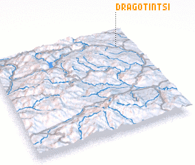 Places with similar names to Dragotintsi, Bulgaria :: Disclaimer :: Information on this page comes without warranty of any kind |
||
|
Where is Dragotintsi? Elevation and coordinates ::
Latitude (lat): 42°51'0"N Longitude (lon): 22°54'0"E
Elevation (approx.): 718m (map arrows pan, magnifying glasses zoom) |
||
|
Visiting Dragotintsi? Hotel/Accommodation ::
Book a hotel in Dragotintsi Travel Guide ::
Buy a travel guide for Bulgaria rental cars ::
car rental offers GPS waypoint ::
download a GPX waypoint (PoI) of Dragotintsi for your GPS receiver
|
||