|
search place name
|
||
Golemanovo (Vidin, Bulgaria)Golemanovo is a town in the Vidin region of Bulgaria. An overview map of the region around Golemanovo is displayed below.
regional and 3d topo map of Golemanovo, Bulgaria ::

Golemanovo airports ::
The nearest airport is INI - Nis, located 80.7 km south west of Golemanovo.
Other airports nearby include CRA - Craiova (123.6 km east), SOF - Sofia (157.0 km south east), CSB - Caransebes (167.1 km north), PRN - Pristina (188.7 km south west), Nearby towns ::
Dregichevi Kolibi (3.9km north west) //
Izvor Makhala (6.3km south) //
Khalovski Kolibi (6.5km north) //
Halovo (6.5km north west) //
Shishentsi (7.0km north) //
Gradskovski Kolibi (8.7km north) //
Shipikova Makhala (8.8km north) //
Kula (7.1km south east) //
Borilovets (9.7km north east) //
Poletkovtsi (9.1km south east) //
[all distances 'as the bird flies' and approximate] 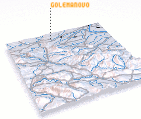 Places with similar names to Golemanovo, Bulgaria ::
// Klemënovo (RU)
// Klemënovo (RU)
// Kleymënovo (RU)
// Kleymënovo (RU)
// Kleymënovo (RU)
// Kelimanefy (MG)
// Kilmanagh (US)
// Kal'manovy (RU)
// Kaľamenová (SK)
// Kálmanov (SK)
Disclaimer :: Information on this page comes without warranty of any kind |
||
|
Where is Golemanovo? Elevation and coordinates ::
Latitude (lat): 43°55'20"N Longitude (lon): 22°26'46"E
Elevation (approx.): 309m (map arrows pan, magnifying glasses zoom) |
||
|
Visiting Golemanovo? Hotel/Accommodation ::
Book a hotel in Golemanovo Travel Guide ::
Buy a travel guide for Bulgaria rental cars ::
car rental offers GPS waypoint ::
download a GPX waypoint (PoI) of Golemanovo for your GPS receiver
|
||