|
search place name
|
||
Pavasari (Dobeles Rajons, Latvia)Pavasari is a town in the Dobeles Rajons region of Latvia. An overview map of the region around Pavasari is displayed below.
regional and 3d topo map of Pavasari, Latvia ::
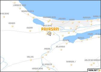
Nearby towns ::
Gātciems (1.0km north east) //
Līkumciems (1.1km north west) //
Branķciems (2.0km north) //
Bāžciems (2.7km north) //
Straupciems (2.5km east) //
Sloka (4.6km north) //
Kauguri (5.5km north) //
Kaugurciems (5.8km north) //
Pogas (5.8km south) //
(( Silenieki )) (5.5km south east) //
Remesi (4.2km south east) //
Pērnciems (3.9km east) //
Vaivari (5.8km north east) //
(( Lielciems )) (7.0km south) //
Kūdra (4.6km north west) //
Krastciems (5.0km north east) //
Tīreļi (8.0km south) //
Spuņciems (5.0km east) //
Jaunķemeri (7.8km north west) //
Asari (6.7km north east) //
Kaļķis (9.7km south west) //
Bigauņciems (9.3km north west) //
[all distances 'as the bird flies' and approximate] 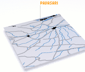 Places with similar names to Pavasari, Latvia :: Disclaimer :: Information on this page comes without warranty of any kind |
||
|
Where is Pavasari? Elevation and coordinates ::
Latitude (lat): 56°54'45"N Longitude (lon): 23°36'51"E
Elevation (approx.): 1m (map arrows pan, magnifying glasses zoom) |
||
|
Visiting Pavasari? Hotel/Accommodation ::
Book a hotel in Pavasari Travel Guide ::
Buy a travel guide for Latvia rental cars ::
car rental offers GPS waypoint ::
download a GPX waypoint (PoI) of Pavasari for your GPS receiver
|
||