|
search place name
|
||
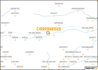
Cioara de Sus (Covurlui, Romania)Cioara de Sus is a town in the Covurlui region of Romania. An overview map of the region around Cioara de Sus is displayed below.
regional and 3d topo map of Cioara de Sus, Romania ::
Cioara de Sus airports ::
The nearest airport is CLJ - Cluj-napoca Cluj Napoca, located 54.3 km north east of Cioara de Sus.
Other airports nearby include TGM - Tirgu Mures Vidrasau (87.3 km east), SBZ - Sibiu (91.2 km south east), OMR - Oradea (127.4 km north west), CSB - Caransebes (133.6 km south west), Nearby towns ::
Pruni (0.0km north) //
Baia de Arieş (0.0km north) //
Dîmbureni (0.0km north) //
Durăşti (0.0km north) //
Simuleşti (0.0km north) //
Gutri (0.0km north) //
Cîmpeneşti (0.0km north) //
Ambru (0.0km north) //
Sartăş (1.3km east) //
Muncel (3.2km south west) //
Brăzeşti (3.2km north east) //
După Deal (4.5km north east) //
Valea Lupşei (3.8km west) //
Inceşti (7.5km north) //
Corneşti (7.5km north) //
Măcreşti (6.8km south east) //
Geamăna (9.0km south west) //
[all distances 'as the bird flies' and approximate]  Places with similar names to Cioara de Sus, Romania ::
// Sırt Çiçi (AZ)
// Seredzice (PL)
// Sieradzice (PL)
// Seredžius (LT)
// Sard Sīseh (IR)
// Sertʼe Sos (ET)
// Zahrádčice (CZ)
// Surudžici (CS)
Disclaimer :: Information on this page comes without warranty of any kind |
||
|
Where is Cioara de Sus? Elevation and coordinates ::
Latitude (lat): 46°23'0"N Longitude (lon): 23°17'0"E
Elevation (approx.): 489m (map arrows pan, magnifying glasses zoom) |
||
|
Visiting Cioara de Sus? Hotel/Accommodation ::
Book a hotel in Cioara de Sus Travel Guide ::
Buy a travel guide for Romania rental cars ::
car rental offers GPS waypoint ::
download a GPX waypoint (PoI) of Cioara de Sus for your GPS receiver
|
||