|
search place name
|
||
Pintic (Covurlui, Romania)Pintic is a town in the Covurlui region of Romania. An overview map of the region around Pintic is displayed below.
regional and 3d topo map of Pintic, Romania ::

Pintic airports ::
The nearest airport is SCV - Suceava Stefan Cel Mare, located 88.2 km north east of Pintic.
Other airports nearby include BCM - Bacau (98.0 km south east), TGM - Tirgu Mures Vidrasau (121.7 km south west), IAS - Iasi (138.7 km east), SBZ - Sibiu (188.0 km south west), Nearby towns ::
Poiana Grinţieşului (3.1km north east) //
Poiana (3.1km north east) //
Bradu (4.2km north east) //
Poiana Nouă (5.3km south west) //
Napiros (5.3km south west) //
Poiana Veche (5.3km south west) //
Tulgheş (5.3km south west) //
Putna Mare (7.5km south west) //
Grinţieş (8.3km north east) //
Grinţieşu Mic (9.0km north east) //
[all distances 'as the bird flies' and approximate] 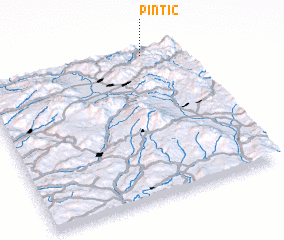 Places with similar names to Pintic, Romania ::
// Panteik (MM)
// Pontaga (MM)
// Pine Tuckey (US)
// Pinetucky (US)
// Pan Tak (US)
// Pentik (MY)
// Ponteggia (IT)
// Poniatówka (PL)
// Pintic (RO)
// Pinticu (RO)
Disclaimer :: Information on this page comes without warranty of any kind |
||
|
Where is Pintic? Elevation and coordinates ::
Latitude (lat): 46°59'0"N Longitude (lon): 25°49'0"E
Elevation (approx.): 661m (map arrows pan, magnifying glasses zoom) |
||
|
Visiting Pintic? Hotel/Accommodation ::
Book a hotel in Pintic Travel Guide ::
Buy a travel guide for Romania rental cars ::
car rental offers GPS waypoint ::
download a GPX waypoint (PoI) of Pintic for your GPS receiver
|
||