|
search place name
|
||
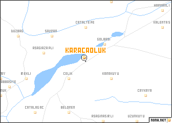
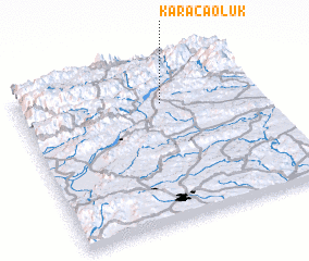
Karacaoluk (Adıyaman, Turkey)Karacaoluk is a town in the Adıyaman region of Turkey. An overview map of the region around Karacaoluk is displayed below.
regional and 3d topo map of Karacaoluk, Turkey ::
Karacaoluk airports ::
The nearest airport is MLX - Malatya Erhac, located 87.4 km north east of Karacaoluk.
Other airports nearby include GZT - Gaziantep Oguzeli (89.7 km south), EZS - Elazig (176.1 km north east), ALP - Aleppo Intl (177.3 km south), ERC - Erzincan (274.6 km north east), Nearby towns ::
 Places with similar names to Karacaoluk, Turkey ::
// Kargalyk (AZ)
// Qarakolluq (AZ)
// Qarğalıg (AZ)
// Gryglaki (PL)
// Krogulec (PL)
// Krykulec (PL)
// Kirkliukai (LT)
// Karakullak (AL)
// Karakolköy (TR)
// Karakolköy (TR)
Disclaimer :: Information on this page comes without warranty of any kind |
||
|
Where is Karacaoluk? Elevation and coordinates ::
Latitude (lat): 37°45'0"N Longitude (lon): 37°36'0"E
Elevation (approx.): 1081m (map arrows pan, magnifying glasses zoom) |
||
|
Visiting Karacaoluk? Hotel/Accommodation ::
Book a hotel in Karacaoluk Travel Guide ::
Buy a travel guide for Turkey rental cars ::
car rental offers GPS waypoint ::
download a GPX waypoint (PoI) of Karacaoluk for your GPS receiver
|
||