|
search place name
|
||
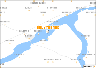
Belyy Bereg (Ukraine)Belyy Bereg is a town in Ukraine. An overview map of the region around Belyy Bereg is displayed below.
regional and 3d topo map of Belyy Bereg, Ukraine ::
Belyy Bereg airports ::
The nearest airport is IEV - Kiev Zhuliany Intl, located 69.9 km south east of Belyy Bereg.
Other airports nearby include KBP - Kiev Boryspil Intl (94.0 km south east), GME - Gomel (189.9 km north), Nearby towns ::
 Places with similar names to Belyy Bereg, Ukraine ::
// Bleiburg (AT)
// Bahlburg (DE)
// Balberg (DE)
// Billbrook (DE)
// Blauberg (DE)
// Bollbrügge (DE)
// Beli Breg (BG)
// Belbarak (TR)
// Belyy Bereg (UA)
// Blouberg (ZA)
Disclaimer :: Information on this page comes without warranty of any kind |
||
|
Where is Belyy Bereg? Elevation and coordinates ::
Latitude (lat): 50°57'0"N Longitude (lon): 29°58'0"E
Elevation (approx.): 107m (map arrows pan, magnifying glasses zoom) |
||
|
Visiting Belyy Bereg? Hotel/Accommodation ::
Book a hotel in Belyy Bereg Travel Guide ::
Buy a travel guide for Ukraine rental cars ::
car rental offers GPS waypoint ::
download a GPX waypoint (PoI) of Belyy Bereg for your GPS receiver
|
||