|
search place name
|
||
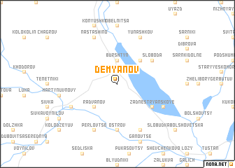
Demʼyanov (Ukraine)Demʼyanov is a town in Ukraine. An overview map of the region around Demʼyanov is displayed below.
regional and 3d topo map of Demʼyanov, Ukraine ::
Demʼyanov airports ::
The nearest airport is LWO - Lvov Lviv Intl, located 81.0 km north west of Demʼyanov.
Other airports nearby include BAY - Baia Mare Tautii Magheraus (195.1 km south west), SUJ - Satu Mare (213.6 km south west), SCV - Suceava Stefan Cel Mare (213.9 km south east), Nearby towns ::
Burshtyn (3.7km north) //
Radvanov (4.4km south west) //
Korostovichi (4.4km north east) //
Lyudvikuvka (4.4km north east) //
Zadnestryanskoye (5.2km south east) //
Sloboda (5.2km north east) //
Ostrov (7.4km south) //
Perlovtse (7.8km south) //
Martynuv Stary (6.1km south west) //
Demeshkovtsy (7.8km south) //
Bovshev (6.1km south east) //
Nastashino (7.8km north) //
Yunashkov (7.8km north) //
[all distances 'as the bird flies' and approximate] 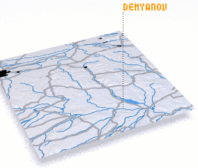 Places with similar names to Demʼyanov, Ukraine ::
// Tam'yanova (RU)
// Damyanovo (BG)
// Dem”yanovo (RU)
// Dem'yanovo (RU)
// Dem'yanovo (RU)
// Dem'yanovo (RU)
// Dem'yanovo (RU)
// Dem'yanovo (RU)
// Dem'yanovo (RU)
Disclaimer :: Information on this page comes without warranty of any kind |
||
|
Where is Demʼyanov? Elevation and coordinates ::
Latitude (lat): 49°14'0"N Longitude (lon): 24°38'0"E
Elevation (approx.): 264m (map arrows pan, magnifying glasses zoom) |
||
|
Visiting Demʼyanov? Hotel/Accommodation ::
Book a hotel in Demʼyanov Travel Guide ::
Buy a travel guide for Ukraine rental cars ::
car rental offers GPS waypoint ::
download a GPX waypoint (PoI) of Demʼyanov for your GPS receiver
|
||