|
search place name
|
||
Kurakhovka (Ukraine)Kurakhovka is a town in Ukraine. An overview map of the region around Kurakhovka is displayed below.
regional and 3d topo map of Kurakhovka, Ukraine ::

Kurakhovka airports ::
The nearest airport is DOK - Donetsk Intl, located 26.9 km east of Kurakhovka.
Nearby towns ::
Novo-Sofiyevka (2.5km east) //
Gornyak (3.9km north) //
Zhelannaya Nomer Vtoroy (3.1km north east) //
Volchanskiy (4.5km south west) //
Maksimilianovka (5.6km south) //
Zhelannaya Nomer Pervyy (5.2km north east) //
Ukrainsk (7.4km north) //
Novoselidovka (5.3km west) //
Zelënyy (5.3km east) //
Roya (6.7km south west) //
Oktyabrʼskoye (7.5km south west) //
Georgiyevka (8.3km south east) //
Tsukurino (8.9km north west) //
[all distances 'as the bird flies' and approximate] 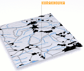 Places with similar names to Kurakhovka, Ukraine ::
// Karkhovka (UA)
// Gorokhovka (RU)
// Gorokhovka (RU)
// Gorokhovka (RU)
// Gorokhovka (RU)
// Gorokhovka (RU)
// Gorokhovka (RU)
// Gorokhovka (RU)
// Gorokhovka (RU)
// Grekhovka (KZ)
Disclaimer :: Information on this page comes without warranty of any kind |
||
|
Where is Kurakhovka? Elevation and coordinates ::
Latitude (lat): 48°2'0"N Longitude (lon): 37°23'0"E
Elevation (approx.): 146m (map arrows pan, magnifying glasses zoom) |
||
|
Visiting Kurakhovka? Hotel/Accommodation ::
Book a hotel in Kurakhovka Travel Guide ::
Buy a travel guide for Ukraine rental cars ::
car rental offers GPS waypoint ::
download a GPX waypoint (PoI) of Kurakhovka for your GPS receiver
|
||