|
search place name
|
||
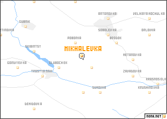
Mikhalëvka (Ukraine)Mikhalëvka is a town in Ukraine. An overview map of the region around Mikhalëvka is displayed below.
regional and 3d topo map of Mikhalëvka, Ukraine ::
Mikhalëvka airports ::
The nearest airport is KIV - Kichinau Fir/acc/com Chisinau Intl, located 184.5 km south of Mikhalëvka.
Other airports nearby include IAS - Iasi (204.9 km south west), IEV - Kiev Zhuliany Intl (218.3 km north), KBP - Kiev Boryspil Intl (225.4 km north east), Nearby towns ::
Petrashevka (2.2km south east) //
Poborka (3.9km north) //
Glubochek (4.1km south west) //
Kosharentsy (7.4km south) //
Sobolevka (6.7km north east) //
Sumovka (7.8km south) //
Brodok (6.1km north east) //
[all distances 'as the bird flies' and approximate] 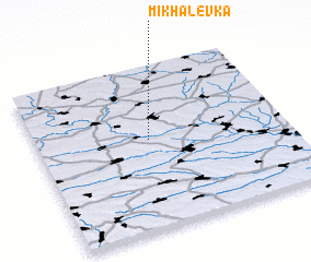 Places with similar names to Mikhalëvka, Ukraine ::
// Mikhalëvka (UA)
// Mikhaluvka (UA)
// Mikhaylivka (UA)
// Mikhaylovka (UA)
// Mikhaylovka (UA)
// Mikhaylovka (UA)
// Mikhaylovka (UA)
// Mikhaylovka (UA)
// Mikhaylovka (UA)
// Mikhaylovka (UA)
Disclaimer :: Information on this page comes without warranty of any kind |
||
|
Where is Mikhalëvka? Elevation and coordinates ::
Latitude (lat): 48°33'0"N Longitude (lon): 29°27'0"E
Elevation (approx.): 189m (map arrows pan, magnifying glasses zoom) |
||
|
Visiting Mikhalëvka? Hotel/Accommodation ::
Book a hotel in Mikhalëvka Travel Guide ::
Buy a travel guide for Ukraine rental cars ::
car rental offers GPS waypoint ::
download a GPX waypoint (PoI) of Mikhalëvka for your GPS receiver
|
||