|
search place name
|
||
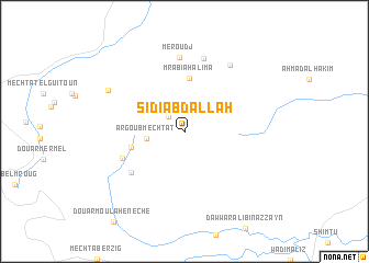
Sidi Abd Allah (Jendouba, Tunisia)Sidi Abd Allah is a town in the Jendouba region of Tunisia. An overview map of the region around Sidi Abd Allah is displayed below.
regional and 3d topo map of Sidi Abd Allah, Tunisia ::
Sidi Abd Allah airports ::
The nearest airport is AAE - Annaba, located 63.2 km north west of Sidi Abd Allah.
Other airports nearby include TEE - Tebessa Cheikh Larbi Tebessi (131.5 km south), TUN - Tunis Carthage (161.3 km east), CZL - Constantine Mohamed Boudiaf Intl (167.8 km west), Nearby towns ::
Hammam el Fezoua (2.0km north west) //
Argoub Mechtat (3.2km west) //
Mrabia Halima (5.5km north) //
Douar el Bheïra (4.7km west) //
Douar Ouled Bou Zaria (6.0km south west) //
Douar Oulad el Kalaa (5.8km south west) //
Meroudj (7.5km north) //
Rmel es Safsaf (7.6km north) //
Rmel Ben Msadek (7.7km north east) //
Mechta Aïn Chaâra (7.5km north west) //
[all distances 'as the bird flies' and approximate]  Places with similar names to Sidi Abd Allah, Tunisia ::
// Sidi Abdallah (MA)
// Sidi Abdallah (MA)
// Sidi Bou Dala (MA)
// Sīdī ‘Abd Allāh (TN)
// Sayyid ‘Abd ‘Alī (IQ)
// Sayyid ‘Abd Allāh (IQ)
// Seyyed ‘Abdollāh (IR)
// Seyyed ‘Abdollāh (IR)
// Sidi Abdallah (MA)
// Sidi Abdallah (MA)
Disclaimer :: Information on this page comes without warranty of any kind |
||
|
Where is Sidi Abd Allah? Elevation and coordinates ::
Latitude (lat): 36°35'8"N Longitude (lon): 8°27'9"E
Elevation (approx.): 620m (map arrows pan, magnifying glasses zoom) |
||
|
Visiting Sidi Abd Allah? Hotel/Accommodation ::
Book a hotel in Sidi Abd Allah Travel Guide ::
Buy a travel guide for Tunisia rental cars ::
car rental offers GPS waypoint ::
download a GPX waypoint (PoI) of Sidi Abd Allah for your GPS receiver
|
||