|
search place name
|
||
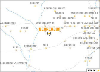
Benacazón (Andalucía, Spain)Benacazón is a town in the Andalucía region of Spain. An overview map of the region around Benacazón is displayed below.
regional and 3d topo map of Benacazón, Spain ::
Benacazón airports ::
The nearest airport is SVQ - Sevilla, located 26.8 km east of Benacazón.
Other airports nearby include OZP - Sevilla Moron Ab (54.0 km east), XRY - Jerez (68.1 km south), ODB - Cordoba (129.9 km north east), GIB - Gibraltar (152.4 km south east), Nearby towns ::
La Estación de Benacazón (2.4km north west) //
Sanlúcar la Mayor (4.0km north) //
Umbrete (3.5km north east) //
Gelo (4.7km south) //
Bollullos de la Mitación (4.8km south east) //
El Loreto (5.8km north east) //
Villanueva del Ariscal (7.1km north east) //
Espartinas (7.0km north east) //
Olivares (8.0km north) //
Aznalcázar (7.5km south west) //
Almensilla (7.5km south east) //
[all distances 'as the bird flies' and approximate]  Places with similar names to Benacazón, Spain ::
// Bancasan (PH)
// Bungsuan (PH)
// Bennigsen (DE)
// Böingsen (DE)
// Bönnigsen (DE)
// Ban Kaeo Saen (TH)
// Ban Kao Son (TH)
// Ban Ko San (TH)
// Benczyn (PL)
// Bangazeno (CD)
Disclaimer :: Information on this page comes without warranty of any kind |
||
|
Where is Benacazón? Elevation and coordinates ::
Latitude (lat): 37°21'0"N Longitude (lon): 6°11'0"W
Elevation (approx.): 108m (map arrows pan, magnifying glasses zoom) |
||
|
Visiting Benacazón? Hotel/Accommodation ::
Book a hotel in Benacazón Travel Guide ::
Buy a travel guide for Spain rental cars ::
car rental offers GPS waypoint ::
download a GPX waypoint (PoI) of Benacazón for your GPS receiver
|
||