|
search place name
|
||
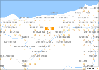
Duña (Cantabria, Spain)Duña is a town in the Cantabria region of Spain. An overview map of the region around Duña is displayed below.
regional and 3d topo map of Duña, Spain ::
Duña airports ::
The nearest airport is SDR - Santander, located 33.8 km east of Duña.
Other airports nearby include BIO - Bilbao (106.0 km east), VIT - Vitoria (131.4 km east), OVD - Aviles Asturias (149.4 km west), VLL - Valladolid (188.1 km south), Nearby towns ::
Toporías (0.0km north) //
Cobijón (1.3km west) //
Ontoria (1.9km south) //
Bustablado (1.3km east) //
Cabrojo (1.3km east) //
Rodezas (2.3km north west) //
Pumalverde (2.7km west) //
La Virgen (2.7km west) //
El Llano (2.7km west) //
Vernejo (3.7km south) //
Periedo (2.7km east) //
Carrejo (3.9km south) //
Cabezón de la Sal (3.9km south) //
Luzmela (3.9km south) //
Riaño de Ibio (3.3km south east) //
Villanueva de la Peña (3.3km south east) //
Ruilobuca (4.6km north west) //
Cóbreces (5.6km north) //
Trasierra (5.6km north) //
Cos (5.6km south) //
Casar (4.0km east) //
Caranceja (4.0km east) //
Ayuela (4.0km west) //
Sierra (5.7km north) //
Santibáñez (5.7km south) //
Ibio (4.4km south east) //
Sierra de Ibio (4.4km south east) //
Canales (4.4km north west) //
La Busta (4.4km north east) //
[all distances 'as the bird flies' and approximate]  Places with similar names to Duña, Spain ::
Disclaimer :: Information on this page comes without warranty of any kind |
||
|
Where is Duña? Elevation and coordinates ::
Latitude (lat): 43°20'0"N Longitude (lon): 4°13'0"W
Elevation (approx.): 275m (map arrows pan, magnifying glasses zoom) |
||
|
Visiting Duña? Hotel/Accommodation ::
Book a hotel in Duña Travel Guide ::
Buy a travel guide for Spain rental cars ::
car rental offers GPS waypoint ::
download a GPX waypoint (PoI) of Duña for your GPS receiver
|
||