|
search place name
|
||
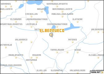
El Berrueco (Madrid, Spain)El Berrueco is a town in the Madrid region of Spain. An overview map of the region around El Berrueco is displayed below.
regional and 3d topo map of El Berrueco, Spain ::
El Berrueco airports ::
The nearest airport is MAD - Madrid Barajas, located 43.3 km south of El Berrueco.
Other airports nearby include TOJ - Madrid Torrejon (43.8 km south), VLL - Valladolid (142.3 km north west), SLM - Salamanca (164.6 km west), VIT - Vitoria (232.4 km north), Nearby towns ::
Sieteiglesias (3.4km north west) //
Cervera de Buitrago (4.0km north) //
Torrelaguna (5.7km south) //
Patones (5.9km east) //
La Cabrera (5.9km west) //
Torremocha de Jarama (7.0km south east) //
Las Navas de Buitrago (7.0km north west) //
Robledillo de la Jara (7.9km north) //
Lozoyuela (6.7km north west) //
Redueña (8.5km south west) //
Cabanillas de la Sierra (9.3km south west) //
Cinco Villas (9.3km north west) //
[all distances 'as the bird flies' and approximate] 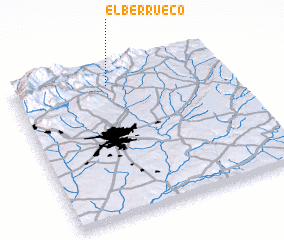 Places with similar names to El Berrueco, Spain ::
// El Brouga (MA)
// Eilberg (DE)
// Ellaberg (DE)
// El Abrigo (ES)
// El Berrueco (ES)
// El Burgo (ES)
// Elburgo (ES)
// El Burrueco (ES)
// Elbrook (US)
// El Barco (CL)
Disclaimer :: Information on this page comes without warranty of any kind |
||
|
Where is El Berrueco? Elevation and coordinates ::
Latitude (lat): 40°53'0"N Longitude (lon): 3°33'0"W
Elevation (approx.): 910m (map arrows pan, magnifying glasses zoom) |
||
|
Visiting El Berrueco? Hotel/Accommodation ::
Book a hotel in El Berrueco Travel Guide ::
Buy a travel guide for Spain rental cars ::
car rental offers GPS waypoint ::
download a GPX waypoint (PoI) of El Berrueco for your GPS receiver
|
||