|
search place name
|
||
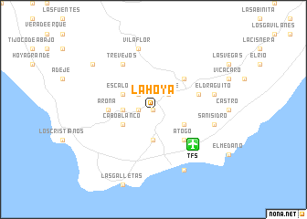
La Hoya (Canarias, Spain)La Hoya is a town in the Canarias region of Spain. An overview map of the region around La Hoya is displayed below.
regional and 3d topo map of La Hoya, Spain ::
La Hoya airports ::
The nearest airport is TFS - Tenerife Sur, located 6.1 km south east of La Hoya.
Other airports nearby include TFN - Tenerife Norte (51.8 km north east), LPA - Gran Canaria (122.1 km east), SPC - Santa Cruz De La Palma La Palma (126.8 km north west), VDE - Hierro (128.5 km west), Nearby towns ::
San Miguel (0.0km north) //
El Roque (1.6km west) //
Jama (2.5km north west) //
Tamaide (2.5km north east) //
Valle de San Lorenzo (3.3km west) //
Aldea Blanca del Llano (3.7km south) //
Buzanada (3.8km south west) //
Cabo Blanco (3.8km south west) //
Escalona (3.8km north west) //
Las Zocas (3.8km south east) //
Atogo (4.9km south east) //
Granadilla de Abona (4.9km north east) //
Arona (4.9km west) //
Charco del Pino (5.2km east) //
Trevejos (6.4km north west) //
San Isidro (6.8km east) //
Vilaflor (7.6km north) //
El Draguito (6.8km east) //
El Abrigo (8.1km south east) //
Ifonche (8.6km north west) //
[all distances 'as the bird flies' and approximate] 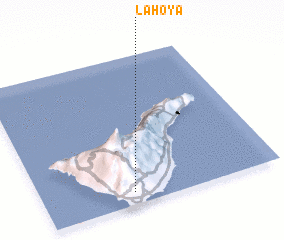 Places with similar names to La Hoya, Spain ::
Disclaimer :: Information on this page comes without warranty of any kind |
||
|
Where is La Hoya? Elevation and coordinates ::
Latitude (lat): 28°5'0"N Longitude (lon): 16°37'0"W
Elevation (approx.): 372m (map arrows pan, magnifying glasses zoom) |
||
|
Visiting La Hoya? Hotel/Accommodation ::
Book a hotel in La Hoya Travel Guide ::
Buy a travel guide for Spain rental cars ::
car rental offers GPS waypoint ::
download a GPX waypoint (PoI) of La Hoya for your GPS receiver
|
||